MyTopo
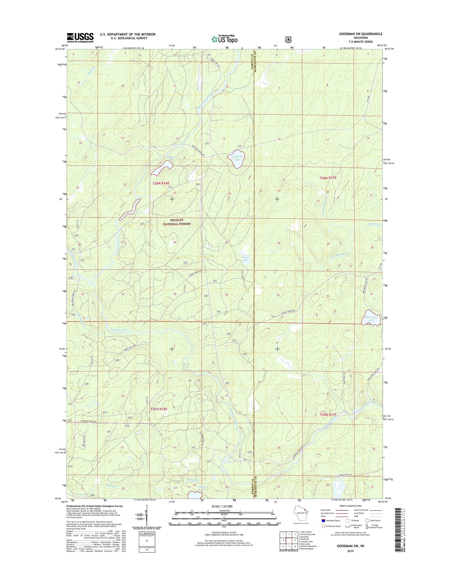
Goodman SW Wisconsin US Topo Map
Couldn't load pickup availability
Also explore the Goodman SW Forest Service Topo of this same quad for updated USFS data
2022 topographic map quadrangle Goodman SW in the state of Wisconsin. Scale: 1:24000. Based on the newly updated USGS 7.5' US Topo map series, this map is in the following counties: Forest, Marinette. The map contains contour data, water features, and other items you are used to seeing on USGS maps, but also has updated roads and other features. This is the next generation of topographic maps. Printed on high-quality waterproof paper with UV fade-resistant inks.
Quads adjacent to this one:
West: Blackwell
Northwest: Lake Gordon
North: Armstrong Creek
Northeast: Goodman
East: Coleman Lake
Southeast: Roaring Rapids
South: McCaslin Mountain
Southwest: Otter Lake
This map covers the same area as the classic USGS quad with code o45088e4.
Contains the following named places: Armstrong Creek, Burnt Bridge Campground, Camp Six Lake, Goose Lake, Halley Creek, Michigan Creek, North Branch Harvey Creek, Porcupine Lake, Revolver Lake, Rock Creek, South Branch Harvey Creek, Valley Lake, ZIP Code: 54125