MyTopo
Connorsville Wisconsin US Topo Map
Couldn't load pickup availability
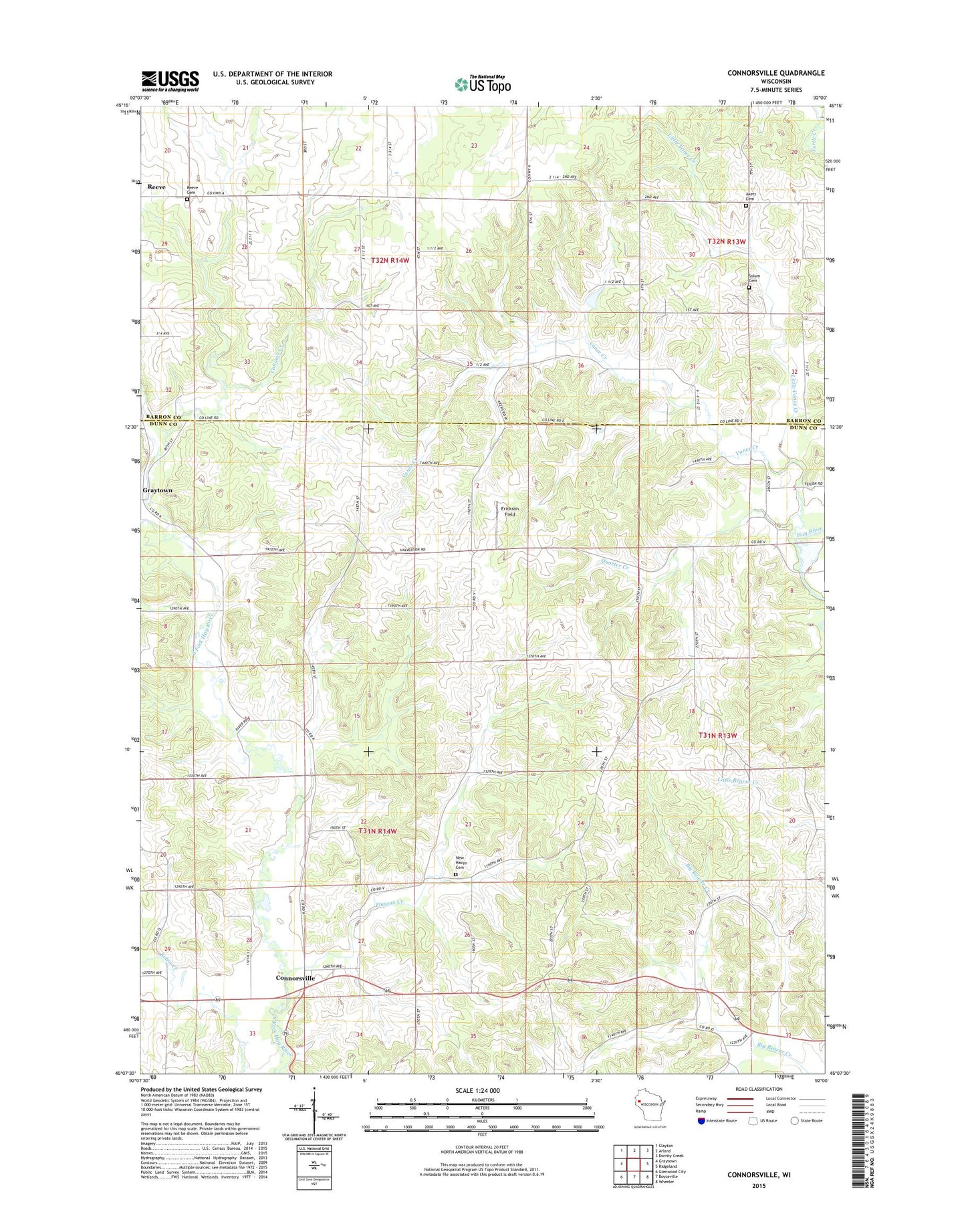
2022 topographic map quadrangle Connorsville in the state of Wisconsin. Scale: 1:24000. Based on the newly updated USGS 7.5' US Topo map series, this map is in the following counties: Dunn, Barron. The map contains contour data, water features, and other items you are used to seeing on USGS maps, but also has updated roads and other features. This is the next generation of topographic maps. Printed on high-quality waterproof paper with UV fade-resistant inks.
Quads adjacent to this one:
West: Graytown
Northwest: Clayton
North: Arland
Northeast: Dorrity Creek
East: Ridgeland
Southeast: Wheeler
South: Boyceville
Southwest: Glenwood City
This map covers the same area as the classic USGS quad with code o45092b1.
Contains the following named places: Akers Cemetery, Bolen School, Connors Creek, Connorsville, Erickson Field, Flayton Creek, Forest Grove School, Little Vance Creek, New Haven Cemetery, Nordby Dam, Oak Lawn School, Pleasant Valley School, Prairie Farm Heights School, Quarter Creek, Reeve Cemetery, Solum Cemetery, Thatcher Park, Town of New Haven, Vance Creek, Vance Creek School, West Akers Church