MyTopo
Glenwood City Wisconsin US Topo Map
Couldn't load pickup availability
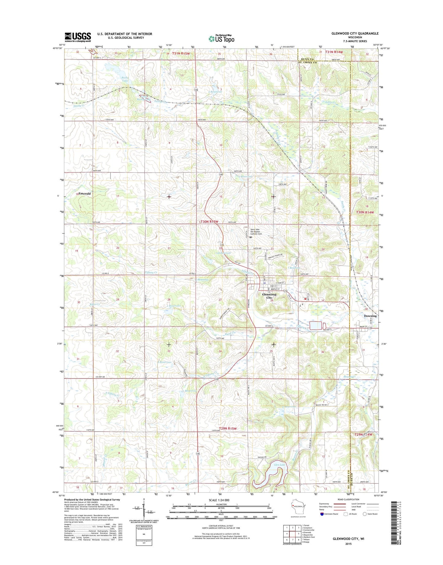
2022 topographic map quadrangle Glenwood City in the state of Wisconsin. Scale: 1:24000. Based on the newly updated USGS 7.5' US Topo map series, this map is in the following counties: St. Croix, Dunn. The map contains contour data, water features, and other items you are used to seeing on USGS maps, but also has updated roads and other features. This is the next generation of topographic maps. Printed on high-quality waterproof paper with UV fade-resistant inks.
Quads adjacent to this one:
West: Emerald
Northwest: Forest
North: Graytown
Northeast: Connorsville
East: Boyceville
Southeast: Knapp
South: Wilson
Southwest: Baldwin East
This map covers the same area as the classic USGS quad with code o45092a2.
Contains the following named places: 1 Reservoir, 1.34 Reservoir, 2 Reservoir, 3 Reservoir, 54013, 54734, Beaver Valley School, Bushy Lake, Camp Nine School, City of Glenwood City, Downing, Glen Hills 1 G-716 Dam, Glen Hills 10 G-716 Dam, Glen Hills 11 G-716 Dam, Glen Hills 2 G 716 Dam, Glen Hills 3 G 716 Dam, Glen Hills 4 G-716 Dam, Glen Hills 5 G-716 Dam, Glen Hills 6 G716 Dam, Glen Hills 7 G-716 Dam, Glen Hills 8 G-716 Dam, Glen Hills County Park, Glen Lake, Glenwood City, Glenwood City Ambulance Service, Glenwood City Elementary School, Glenwood City Fire Department, Glenwood City High School, Glenwood City Middle - High School, Glenwood City Police Department, Glenwood City Post Office, Little Bushy Lake, Maple Grove School, Mar-O-Dae Farm Airport, Mission Church, Pine Heights School, Ridge View School, Roddis School, Ryan Creek, Saint John the Baptist Catholic Cemetery, Schindler School, South Tiffany Creek, Stephens Creek, Sunny Slope School, Town of Glenwood, Transitional Skills Center