MyTopo
Boyceville Wisconsin US Topo Map
Couldn't load pickup availability
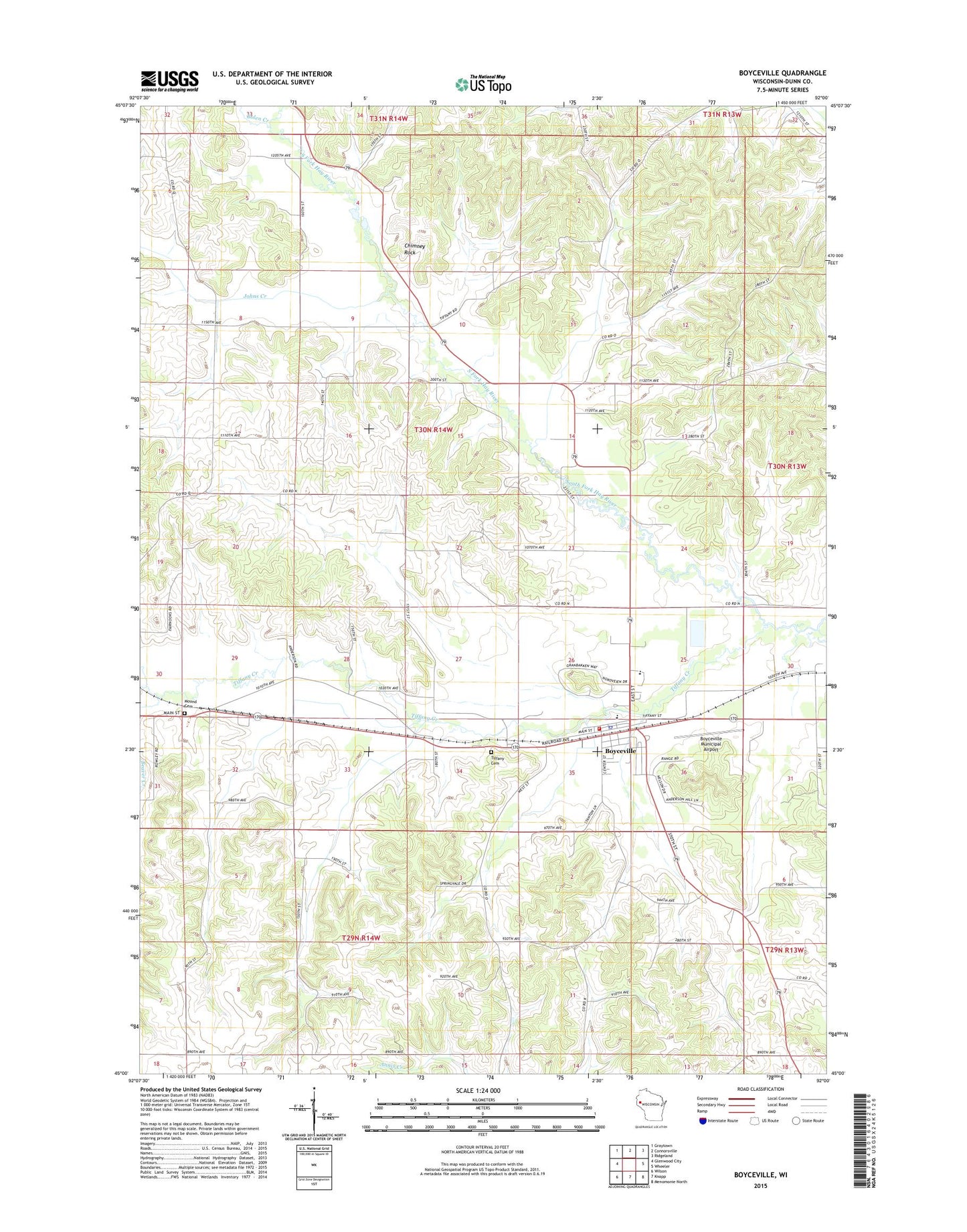
2022 topographic map quadrangle Boyceville in the state of Wisconsin. Scale: 1:24000. Based on the newly updated USGS 7.5' US Topo map series, this map is in the following counties: Dunn. The map contains contour data, water features, and other items you are used to seeing on USGS maps, but also has updated roads and other features. This is the next generation of topographic maps. Printed on high-quality waterproof paper with UV fade-resistant inks.
Quads adjacent to this one:
West: Glenwood City
Northwest: Graytown
North: Connorsville
Northeast: Ridgeland
East: Wheeler
Southeast: Menomonie North
South: Knapp
Southwest: Wilson
This map covers the same area as the classic USGS quad with code o45092a1.
Contains the following named places: Beaver Creek, Bolen Creek, Boyceville, Boyceville Community Ambulance Service, Boyceville Middle / High School, Boyceville Municipal Airport, Boyceville Police Department, Boyceville Post Office, Boyceville Volunteer Fire Department, Chimney Rock, Chimney Rock School, Chimney Rock State Wetlands Area, Ebenezer Church, Goff School, Granger School, Holy Trinity Church, Johns Creek, Maple Ridge School, Midway School, Mound Cemetery, Oak Ridge School, Pleasant Dale School, Pleasant Hill School, Sandy Creek, Tiffany Cemetery, Tiffany Creek, Tiffany Creek Elementary School, Tiffany Townhall, Town of Tiffany, Village of Boyceville, Village of Downing