MyTopo
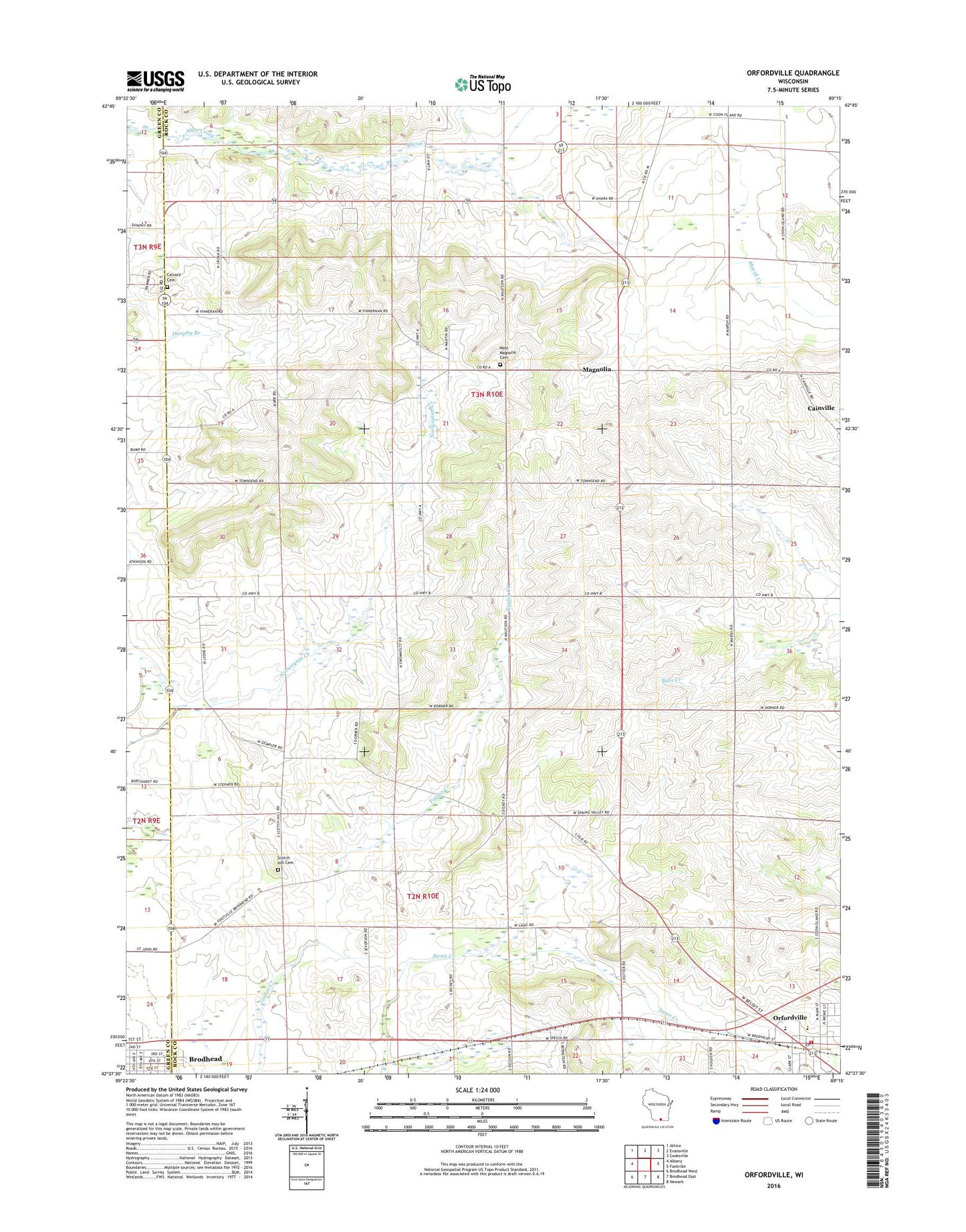
Orfordville Wisconsin US Topo Map
Couldn't load pickup availability
2022 topographic map quadrangle Orfordville in the state of Wisconsin. Scale: 1:24000. Based on the newly updated USGS 7.5' US Topo map series, this map is in the following counties: Rock, Green. The map contains contour data, water features, and other items you are used to seeing on USGS maps, but also has updated roads and other features. This is the next generation of topographic maps. Printed on high-quality waterproof paper with UV fade-resistant inks.
Quads adjacent to this one:
West: Albany
Northwest: Attica
North: Evansville
Northeast: Cooksville
East: Footville
Southeast: Newark
South: Brodhead East
Southwest: Brodhead West
This map covers the same area as the classic USGS quad with code o42089f3.
Contains the following named places: Cainville, Calvary Cemetery, Kinkoona Farm, Magnolia, Maloney Ponds, Orfordville, Orfordville Fire Station, Orfordville Police Department, Orfordville Post Office, Parkview Elementary School, Parkview Junior / Senior High School, Parkview Junior High School, Purdy Park, Scotch Hill Cemetery, Spring Valley, Spring Valley Farm Airport, Town of Magnolia, Town of Spring Valley, Village of Orfordville, West Magnolia Cemetery, WMJB-FM (Evansville)