MyTopo
Footville Wisconsin US Topo Map
Couldn't load pickup availability
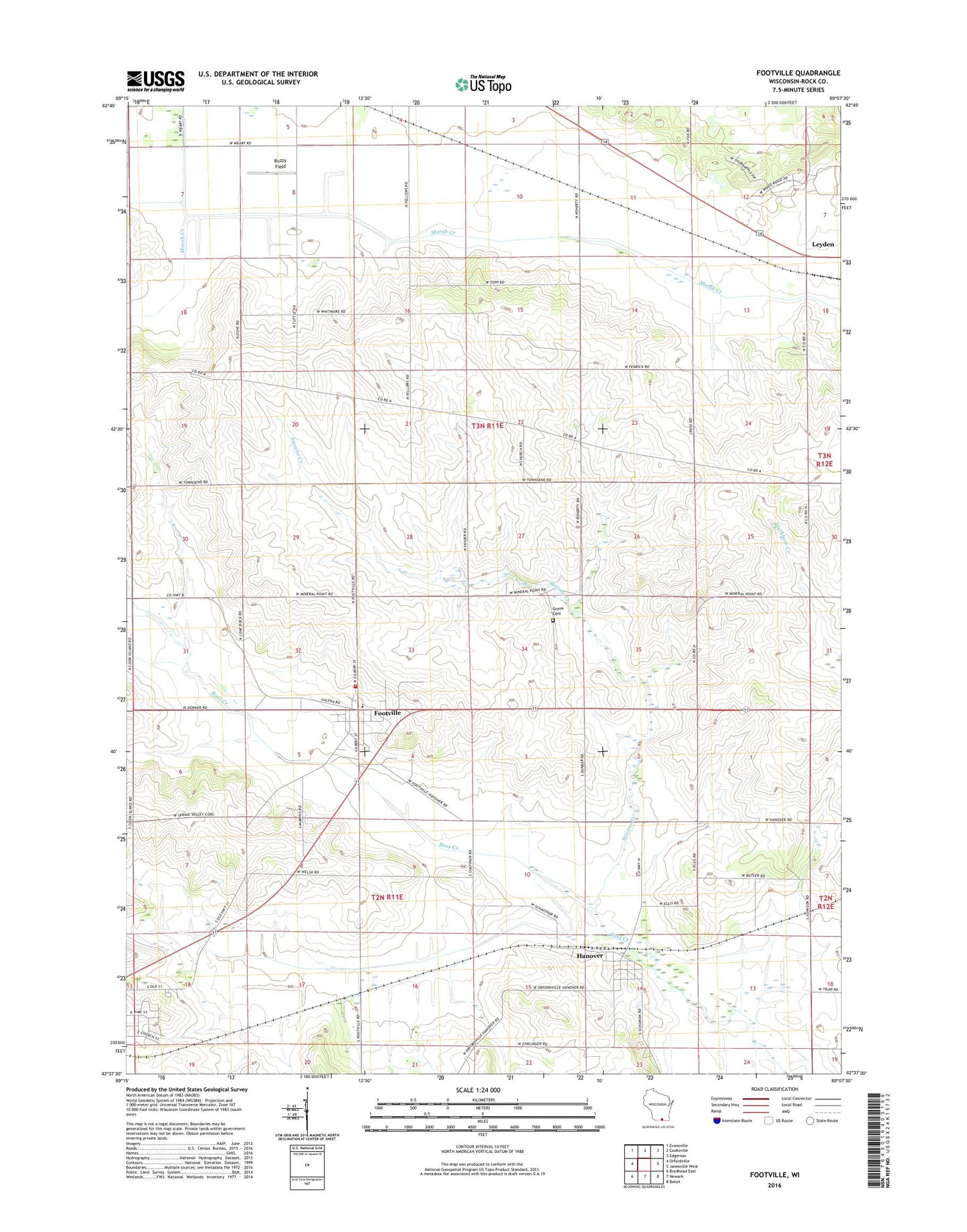
2022 topographic map quadrangle Footville in the state of Wisconsin. Scale: 1:24000. Based on the newly updated USGS 7.5' US Topo map series, this map is in the following counties: Rock. The map contains contour data, water features, and other items you are used to seeing on USGS maps, but also has updated roads and other features. This is the next generation of topographic maps. Printed on high-quality waterproof paper with UV fade-resistant inks.
Quads adjacent to this one:
West: Orfordville
Northwest: Evansville
North: Cooksville
Northeast: Edgerton
East: Janesville West
Southeast: Beloit
South: Newark
Southwest: Brodhead East
This map covers the same area as the classic USGS quad with code o42089f2.
Contains the following named places: Apple Acres Ranch, Ayen Farms, Ballmerland Farms, Bog School, Buzzy Field, Center, Ellis School, Fellows, Footville, Footville Community Fire Department and Emergency Medical Services, Footville Elementary School, Footville Post Office, Footville Wastewater Treatment Facility, Grove Cemetery, Hanover, Hanover Census Designated Place, Kessler Railroad Prairie State Natural Area, Leyden, Pineview Farm, Red Brick School, Stevens Creek, Town of Center, Town of Plymouth, Village of Footville, Wilke Way Farm, WJNW-TV (Janesville), WJVL-FM (Janesville), ZIP Codes: 53537, 53576