MyTopo
Cornell Wisconsin US Topo Map
Couldn't load pickup availability
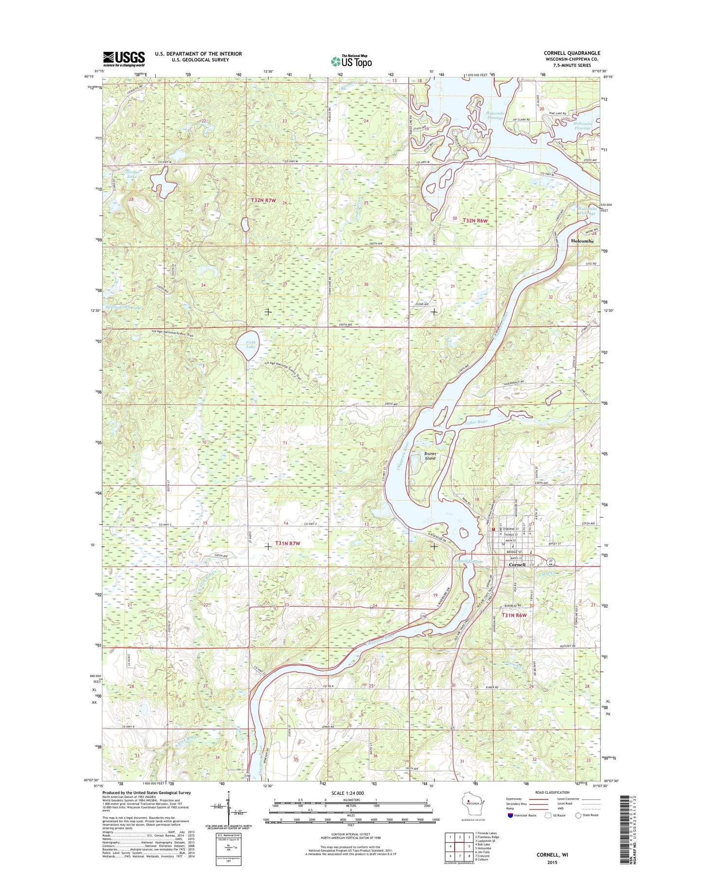
2022 topographic map quadrangle Cornell in the state of Wisconsin. Scale: 1:24000. Based on the newly updated USGS 7.5' US Topo map series, this map is in the following counties: Chippewa. The map contains contour data, water features, and other items you are used to seeing on USGS maps, but also has updated roads and other features. This is the next generation of topographic maps. Printed on high-quality waterproof paper with UV fade-resistant inks.
Quads adjacent to this one:
West: Bob Lake
Northwest: Fireside Lakes
North: Flambeau Ridge
Northeast: Ladysmith SE
East: Holcombe
Southeast: Colburn
South: Crescent
Southwest: Jim Falls
This map covers the same area as the classic USGS quad with code o45091b2.
Contains the following named places: Birch Creek, Bob Creek, Brook View Farms, Brunet Island, Brunet Island State Park, Burnt Creek Flowage Number Two, City of Cornell, Clark Creek, Cornell, Cornell 2WP7 Dam, Cornell Area Ambulance, Cornell Area Fire Department, Cornell Elementary School, Cornell Flowage, Cornell Hydro Generating Station, Cornell Middle - High School, Cornell Police Department, Cornell Post Office, County Forest Crop Land 3 D-12.210 Dam, Cranberry Creek, Fairview School, Faith Baptist Church, First Presbyterian Church, Firth Lake, Firth Lake Trail, Firth School, Fisher River, French Creek, Holcombe 2WP723 Dam, Holcombe Dam, Holcombe Flowage, Holcombe Hydro Generating Station, Holy Cross Catholic Church, Horseshoe Flowage 0.75, Jerome Lake, Kingdom Hall of Jehovahs Witnesses, Lemay Farm, Miller Lake, Moonridge Trail, New Hope Assembly of God Church, North Fork Bob Creek, Our Saviours Lutheran Church, Pine Point County Park, Pleasant Ridge School, Quinn Pit, Roberts School, Saint Johns Lutheran Church, South Fork Bob Creek, Spring Creek Flowage Number Two, Town of Birch Creek, ZIP Code: 54732