MyTopo
Holcombe Wisconsin US Topo Map
Couldn't load pickup availability
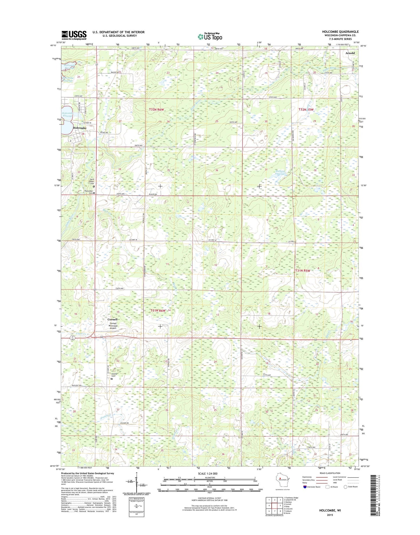
2022 topographic map quadrangle Holcombe in the state of Wisconsin. Scale: 1:24000. Based on the newly updated USGS 7.5' US Topo map series, this map is in the following counties: Chippewa. The map contains contour data, water features, and other items you are used to seeing on USGS maps, but also has updated roads and other features. This is the next generation of topographic maps. Printed on high-quality waterproof paper with UV fade-resistant inks.
Quads adjacent to this one:
West: Cornell
Northwest: Flambeau Ridge
North: Ladysmith SE
Northeast: Sheldon
East: Ruby
Southeast: Huron
South: Colburn
Southwest: Crescent
This map covers the same area as the classic USGS quad with code o45091b1.
Contains the following named places: Amish Parochial School, Arnold, Beaver Creek, Buck Creek, Cornell Municipal Airport, County Forest Crop Land 6 G 1137.1 Dam, Enterprise School, Estella School, Estella Union Cemetery, Hillebrand Farms, Holcombe, Holcombe Cemetery, Holcombe Census Designated Place, Holcombe Elementary School, Holcombe Post Office, Lake Holcombe School, Mallard Flowage, Martin Church, Saint Joseph's Catholic Cemetery, Town of Estella, Town of Lake Holcombe