MyTopo
Ferryville Wisconsin US Topo Map
Couldn't load pickup availability
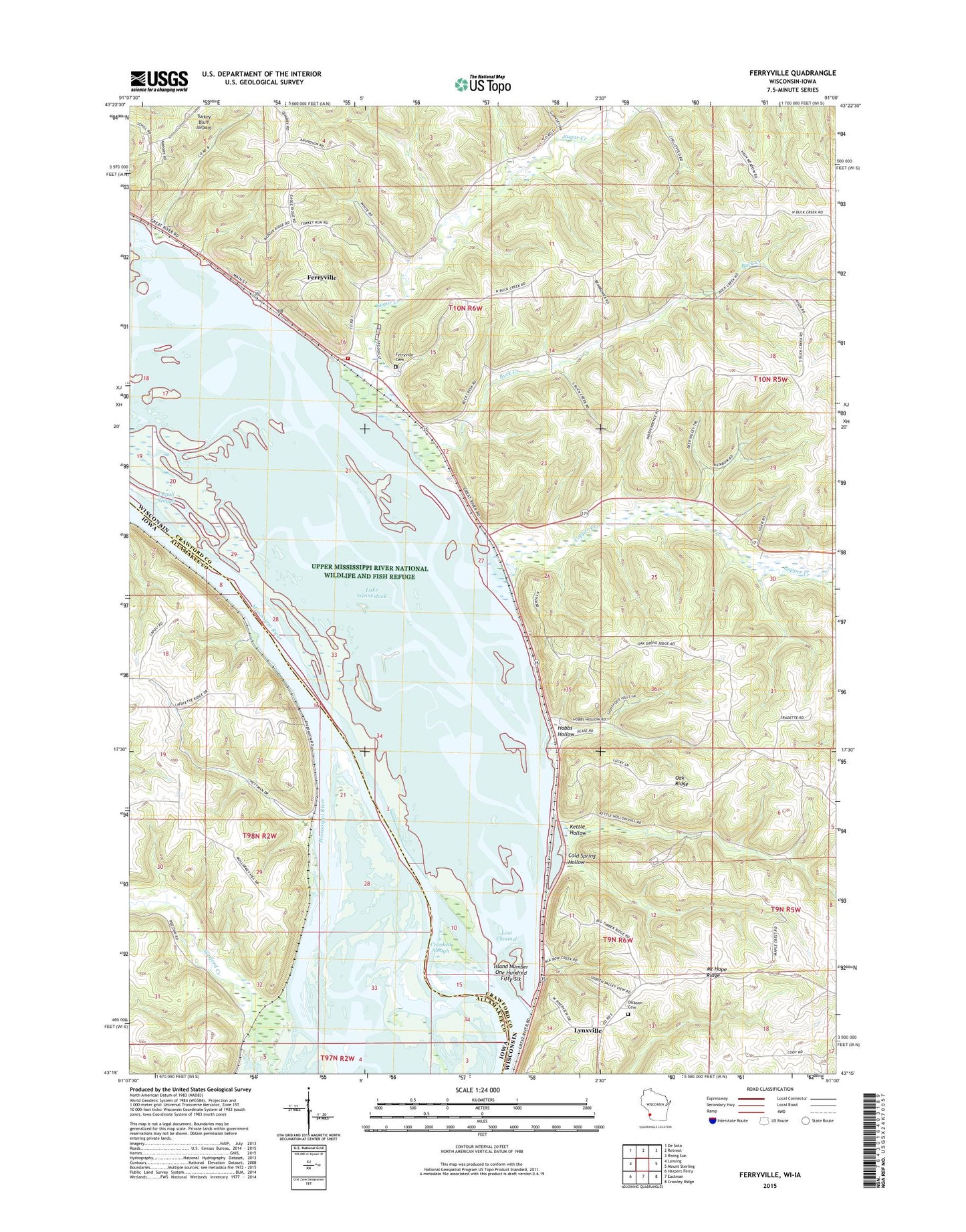
2022 topographic map quadrangle Ferryville in the states of Wisconsin, Iowa. Scale: 1:24000. Based on the newly updated USGS 7.5' US Topo map series, this map is in the following counties: Crawford, Allamakee. The map contains contour data, water features, and other items you are used to seeing on USGS maps, but also has updated roads and other features. This is the next generation of topographic maps. Printed on high-quality waterproof paper with UV fade-resistant inks.
Quads adjacent to this one:
West: Lansing
Northwest: De Soto
North: Retreat
Northeast: Rising Sun
East: Mount Sterling
Southeast: Crowley Ridge
South: Eastman
Southwest: Harpers Ferry
This map covers the same area as the classic USGS quad with code o43091c1.
Contains the following named places: Buck Creek, Buck Creek School, Capoli Slough, Cold Spring Hollow, Cold Spring Landing, Columbus Lake, Copper Creek, Crooked Slough, Dickson Cemetery, Ferryville, Ferryville Cemetery, Ferryville Fire Department and Emergency Medical Responders, Ferryville Post Office, Heytmans Station, Hobbs Hollow, Island Number One Hundred Fifty-One, Island Number One Hundred Fifty-Six, Kettle Hollow, Lake Winneshiek, Lost Channel, Mount Hope Ridge, Mount Hope School, North Branch Copper Creek, Oak Grove School, Oak Ridge, Pool 9 Island, Pool Nine Island, South Branch Copper Creek, Sugar Creek, Sugar Creek Bluff State Natural Area, Town of Freeman, Turkey Bluff Airport, Village of Ferryville, Wexford Creek, ZIP Code: 54628