MyTopo
Eastman Wisconsin US Topo Map
Couldn't load pickup availability
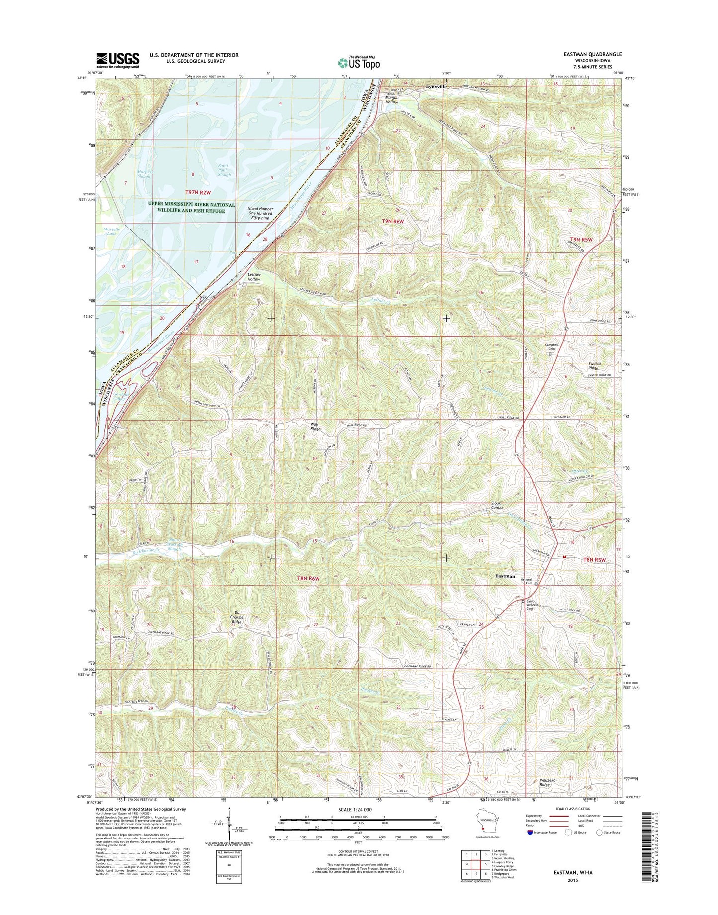
2022 topographic map quadrangle Eastman in the states of Wisconsin, Iowa. Scale: 1:24000. Based on the newly updated USGS 7.5' US Topo map series, this map is in the following counties: Crawford, Allamakee. The map contains contour data, water features, and other items you are used to seeing on USGS maps, but also has updated roads and other features. This is the next generation of topographic maps. Printed on high-quality waterproof paper with UV fade-resistant inks.
Quads adjacent to this one:
West: Harpers Ferry
Northwest: Lansing
North: Ferryville
Northeast: Mount Sterling
East: Crowley Ridge
Southeast: Wauzeka West
South: Bridgeport
Southwest: Prairie du Chien
This map covers the same area as the classic USGS quad with code o43091b1.
Contains the following named places: Bonney School, Butler Lake, Campbell Cemetery, Du Charme Ridge, Du Charme Ridge School, Eastman, Eastman Elementary School, Eastman Post Office, Eastman Volunteer Fire Department, Gimmel Lake, Gordons Bay, Hazen Corners, Hazen Corners School, Island Number One Hundred Fifty-nine, Leitner Creek, Leitner Hollow, Leitner School, Lock and Dam 9, Lock and Dam No, Lynxville, Lynxville Elementary School, Morgan Hollow, National Cemetery, Oil Spring Creek, Phillip School, Pool 9, Rittenhouse Lake, Saint Paul Slough, Saint Wenceslaus Catholic Church Cemetery, Saint Wenceslaus Church, Shaw Hill School, Shulz Crossing Slough, South Elementary School, Village of Eastman, Village of Lynxville, Wagner School, Wall Ridge, Wall Ridge School, ZIP Code: 54626