MyTopo
Durwards Glen Wisconsin US Topo Map
Couldn't load pickup availability
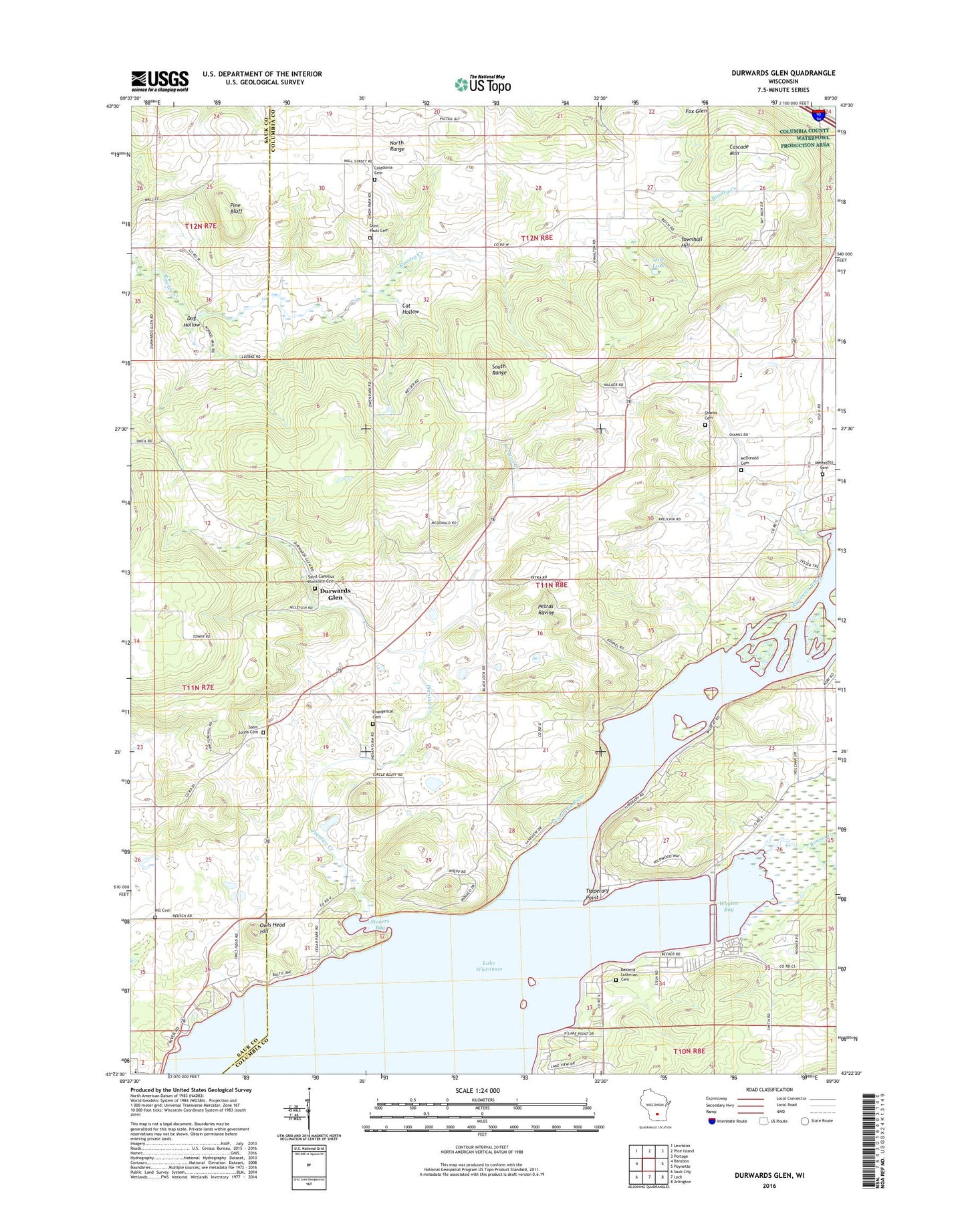
2018 topographic map quadrangle Durwards Glen in the state of Wisconsin. Scale: 1:24000. Based on the newly updated USGS 7.5' US Topo map series, this map is in the following counties: Columbia, Sauk. The map contains contour data, water features, and other items you are used to seeing on USGS maps, but also has updated roads and other features. This is the next generation of topographic maps. Printed on high-quality waterproof paper with UV fade-resistant inks.
Quads adjacent to this one:
West: Baraboo
Northwest: Lewiston
North: Pine Island
Northeast: Portage
East: Poynette
Southeast: Arlington
South: Lodi
Southwest: Sauk City
Contains the following named places: Alloa School, American Ukranian Camp, Caledonia Church, Caledonia Elementary School, Caledonia German Methodist Cemetery, Camp Rest Park, Cascade Mountain, Cat Hollow, Dekorra Church, Dekorra Lutheran Cemetery, Devils Head Golf Course, Dog Hollow, Dog Hollow School, Durwards Glen, Durwards Glen School, Evangelical Cemetery, Happy Hollow Park, Hill Cemetery, Ikey School, Indian Farm Cemetery, Indian Farm School, Lincoln School, Little Church, Lost Lake, Lost Lake State Natural Area, McDonald Cemetery, Merrimac Community Charter School, Methodist Cemetery, Owen Memorial Park, Owls Head Hill, Petras Ravine, Pine Bluff, Prentice Creek, Rowan Creek, Saint Camillus Cemetery, Saint Johns Cemetery, Saint Paul Evangelical Lutheran Cemetery, Saint Pauls Church, Shanks Cemetery, Stoners Bay, Tipperary Point, Town of Caledonia, Townhall Hill, Whalen Bay