MyTopo
Poynette Wisconsin US Topo Map
Couldn't load pickup availability
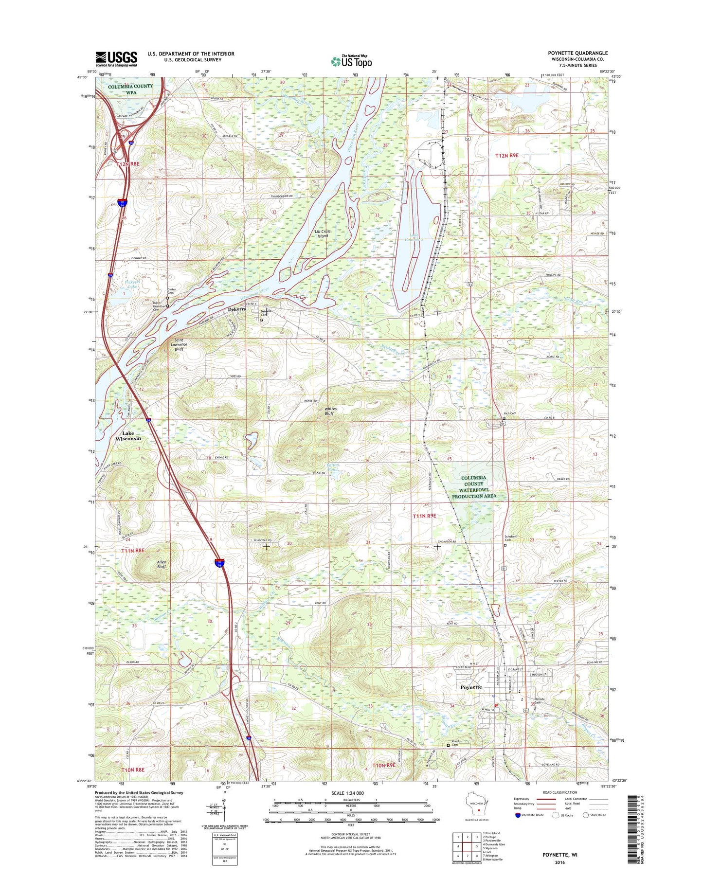
2022 topographic map quadrangle Poynette in the state of Wisconsin. Scale: 1:24000. Based on the newly updated USGS 7.5' US Topo map series, this map is in the following counties: Columbia. The map contains contour data, water features, and other items you are used to seeing on USGS maps, but also has updated roads and other features. This is the next generation of topographic maps. Printed on high-quality waterproof paper with UV fade-resistant inks.
Quads adjacent to this one:
West: Durwards Glen
Northwest: Pine Island
North: Portage
Northeast: Pardeeville
East: Wyocena
Southeast: Morrisonville
South: Arlington
Southwest: Lodi
This map covers the same area as the classic USGS quad with code o43089d4.
Contains the following named places: Allen Bluff, Bancroft Landing Strip, Baraboo River, Columbia Energy Center, Dekorra, Dekorra Cemetery, Dekorra Census Designated Place, Dekorra Elementary School, Duck Creek, Fulton Pond, Ginter Cemetery, Hillside Cemetery, Hinkson Creek, Inch Cemetery, Inch Church, Klaila Cemetery, Lake Columbia, Lib Cross Island, Muir Park, Pacific School, Pickerel Lake, Poynette, Poynette - Dekorra Fire Department and Emergency Medical Services, Poynette Christian School, Poynette Elementary School, Poynette High School, Poynette Middle School, Poynette Police Department, Poynette Post Office, Rocky Run, Rubin - Guenther Cemetery, Saint Lawrence Bluff, Schofield Cemetery, Town of Dekorra, Village of Poynette, Whites Bluff, ZIP Code: 53955