MyTopo
El Paso Wisconsin US Topo Map
Couldn't load pickup availability
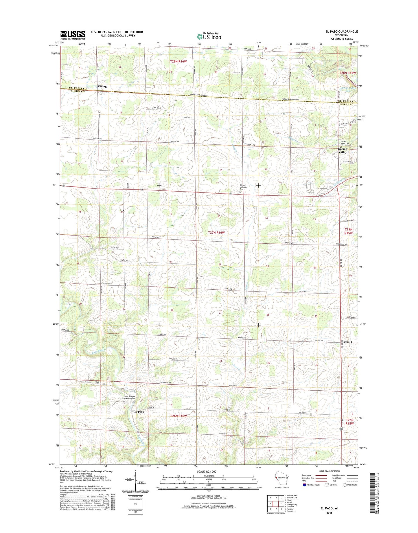
2022 topographic map quadrangle El Paso in the state of Wisconsin. Scale: 1:24000. Based on the newly updated USGS 7.5' US Topo map series, this map is in the following counties: Pierce, St. Croix. The map contains contour data, water features, and other items you are used to seeing on USGS maps, but also has updated roads and other features. This is the next generation of topographic maps. Printed on high-quality waterproof paper with UV fade-resistant inks.
Quads adjacent to this one:
West: Martell
Northwest: Baldwin West
North: Baldwin East
Northeast: Wilson
East: Spring Valley
Southeast: Plum City
South: Waverly
Southwest: Ellsworth
This map covers the same area as the classic USGS quad with code o44092g3.
Contains the following named places: El Paso, Gilman Center School, Gilman Lutheran Cemetery, Gilman Lutheran Church, Gilman School, Gilman Townhall, Locust Grove School, Lone Balsam School, Maple Leaf Orchard, Mines School, Olivet, Peniel Christian School, Sacred Heart Cemetery, Saint Josephs Catholic Cemetery, Saint Josephs Catholic Church, South Hill School, Spring Valley High School, Spring Valley Middle School, Town of Gilman, Viking, Wildwood School, Wood School, ZIP Code: 54767