MyTopo
Spring Valley Wisconsin US Topo Map
Couldn't load pickup availability
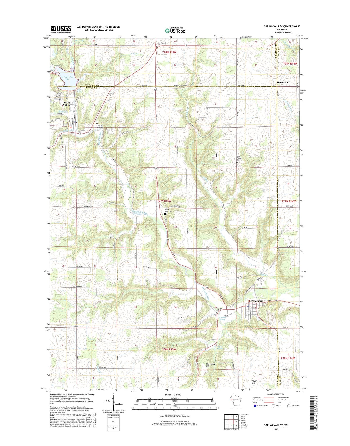
2022 topographic map quadrangle Spring Valley in the state of Wisconsin. Scale: 1:24000. Based on the newly updated USGS 7.5' US Topo map series, this map is in the following counties: Pierce, St. Croix, Dunn. The map contains contour data, water features, and other items you are used to seeing on USGS maps, but also has updated roads and other features. This is the next generation of topographic maps. Printed on high-quality waterproof paper with UV fade-resistant inks.
Quads adjacent to this one:
West: El Paso
Northwest: Baldwin East
North: Wilson
Northeast: Knapp
East: Weston
Southeast: Arkansaw
South: Plum City
Southwest: Waverly
This map covers the same area as the classic USGS quad with code o44092g2.
Contains the following named places: Brookside School, Burkhart Creek, Butternut Park, Cady and Lucas School, Cady Creek, Cady Creek Church, Cady Creek School, Eagle Spring, East Hill School, Eau Galle E30.184 Dam, Elmwood, Elmwood Area Ambulance Service, Elmwood Area Fire Department, Elmwood Elementary School, Elmwood High School, Elmwood Middle School, Elmwood Police Department, Elmwood Post Office, Franklin Spring, Hammond Hill, Handy-Andy Memorial Park, Hatchville, Lake George, Lohn Creek, Lousy Creek, Mines Creek, Oak Ridge Cemetery, Pine Cooley School, Plainview School, Porter Spring, Reeds School, Saint John Cemetery, Saint John Church, Saint Matthew Church, Saint Michael Cemetery, School Number 28, Spring Lake Cemetery, Spring Lake Church, Spring Valley, Spring Valley Area Ambulance, Spring Valley Elementary School, Spring Valley Fire Department, Spring Valley Police Department, Spring Valley Post Office, Town of Spring Lake, Tuttle Hill, Village of Elmwood, Village of Spring Valley, ZIP Code: 54740