
MyTopo
Embarrass Wisconsin US Topo Map
Couldn't load pickup availability
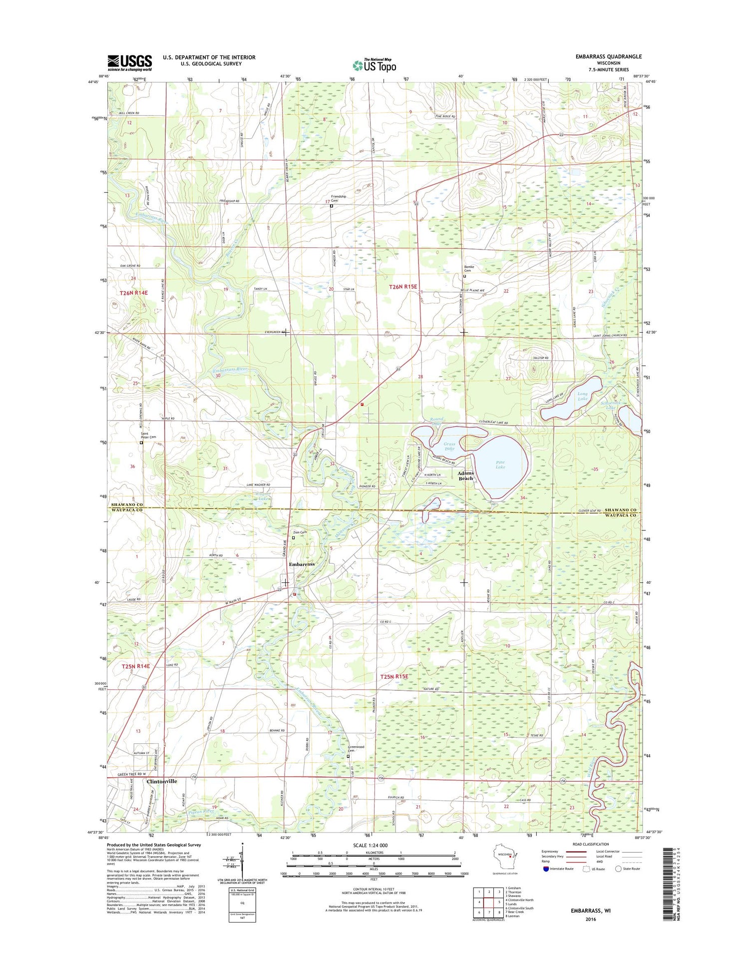
2018 topographic map quadrangle Embarrass in the state of Wisconsin. Scale: 1:24000. Based on the newly updated USGS 7.5' US Topo map series, this map is in the following counties: Shawano, Waupaca. The map contains contour data, water features, and other items you are used to seeing on USGS maps, but also has updated roads and other features. This is the next generation of topographic maps. Printed on high-quality waterproof paper with UV fade-resistant inks.
Quads adjacent to this one:
West: Clintonville North
Northwest: Gresham
North: Thornton
Northeast: Shawano
East: Lunds
Southeast: Leeman
South: Bear Creek
Southwest: Clintonville South
Contains the following named places: Adams Beach, Adams Beach Census Designated Place, Beaver Creek, Belle Plaine, Big Lake, Bomke Cemetery, Embarrass, Embarrass Post Office, Embarrass Volunteer Fire Department, Friendship Cemetery, Grass Lake, Greenwood Cemetery, Long Lake, Matteson Creek, Mill Creek, Pine Lake, Roosevelt School, Round Lake, Saint Johns Church, Saint Martin Church, Saint Peter Cemetery, Saint Peter Church, Schoenick Lake, Shawano Area Fire Department Station 3, Town of Belle Plaine, Town of Matteson, United Church, Village of Embarrass, Wagner Lake, Wolf River School, Woodland School, Zion Lutheran Cemetery, ZIP Codes: 54929, 54933


