MyTopo
Gresham Wisconsin US Topo Map
Couldn't load pickup availability
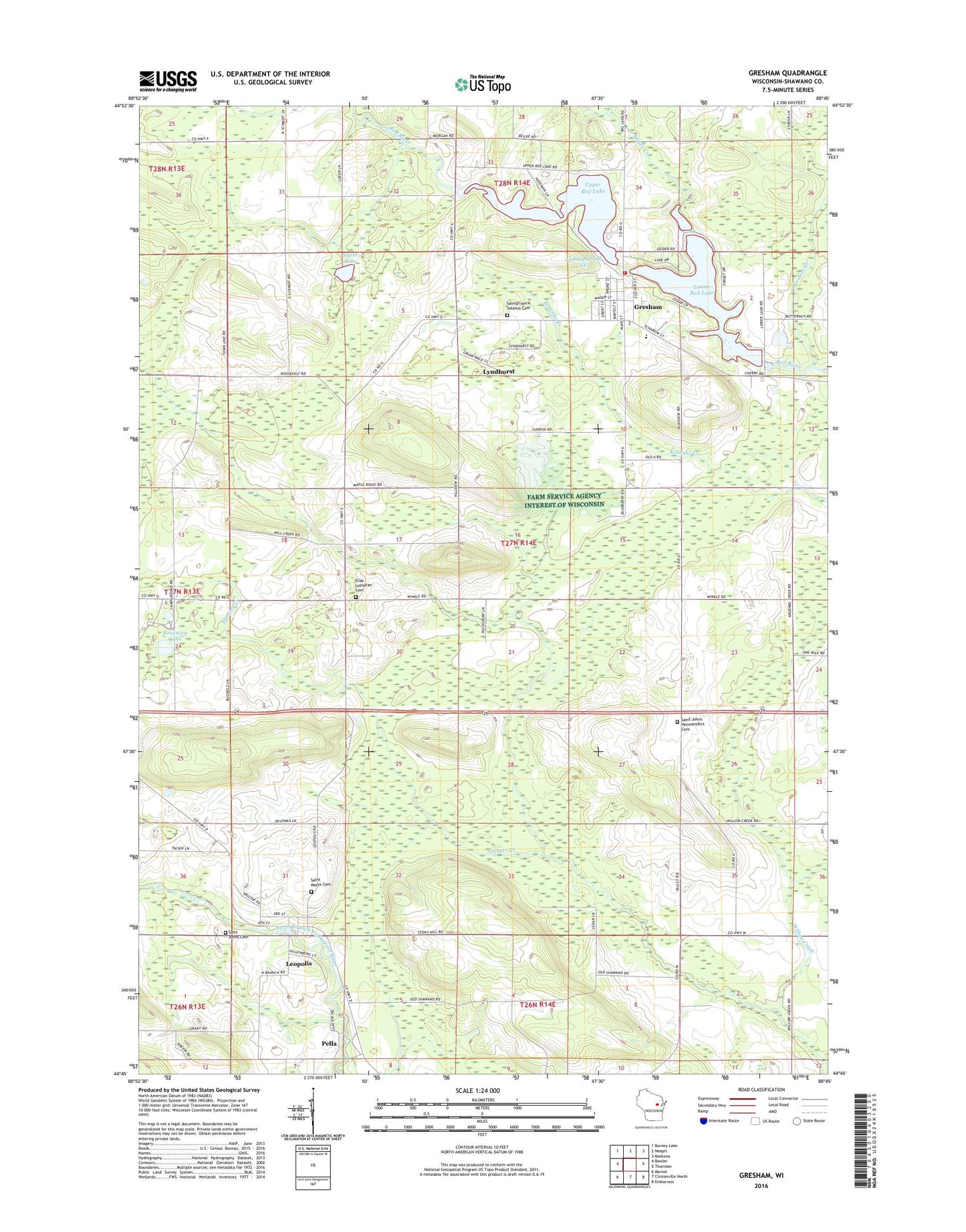
2022 topographic map quadrangle Gresham in the state of Wisconsin. Scale: 1:24000. Based on the newly updated USGS 7.5' US Topo map series, this map is in the following counties: Shawano. The map contains contour data, water features, and other items you are used to seeing on USGS maps, but also has updated roads and other features. This is the next generation of topographic maps. Printed on high-quality waterproof paper with UV fade-resistant inks.
Quads adjacent to this one:
West: Bowler
Northwest: Burney Lake
North: Neopit
Northeast: Keshena
East: Thornton
Southeast: Embarrass
South: Clintonville North
Southwest: Marion
This map covers the same area as the classic USGS quad with code o44088g7.
Contains the following named places: Elias Church, Elias Lutheran Cemetery, Gardner Creek, Gresham, Gresham 2WP 1540 Dam, Gresham Area Fire Department, Gresham Elementary School, Gresham Middle / High School, Gresham Pond 147, Gresham Post Office, Hermansfort School, Hohn School, Jung Hemlock-Beech Forest State Natural Area, Kroening Lake, Leopolis, Leopolis Census Designated Place, Leopolis Post Office, Lower Red Lake, Lyndhurst, Miller Creek, Range Line School, Riverside Park, Saint Francis Solanus Cemetery, Saint John Cemetery, Saint John Lutheran Church, Saint Johns Lutheran Cemetery, Saint Marys Cemetery, Shawano County, Smith Lake, Spencer Creek, Town of Herman, Upper Red Lake, Village of Gresham, Willow Creek, Willow Creek School, ZIP Code: 54948