MyTopo
Thornton Wisconsin US Topo Map
Couldn't load pickup availability
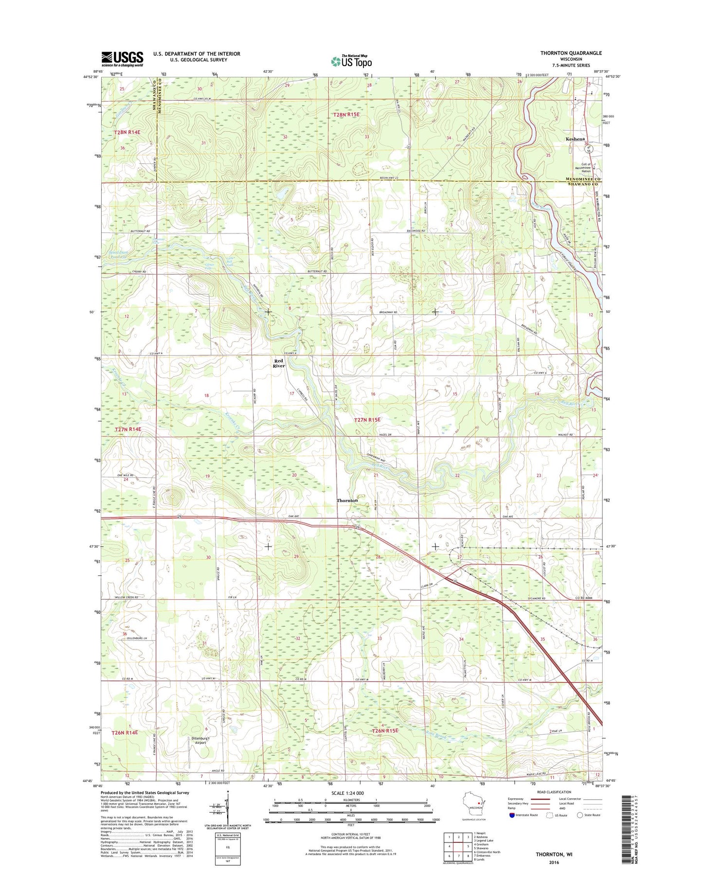
2022 topographic map quadrangle Thornton in the state of Wisconsin. Scale: 1:24000. Based on the newly updated USGS 7.5' US Topo map series, this map is in the following counties: Shawano, Menominee. The map contains contour data, water features, and other items you are used to seeing on USGS maps, but also has updated roads and other features. This is the next generation of topographic maps. Printed on high-quality waterproof paper with UV fade-resistant inks.
Quads adjacent to this one:
West: Gresham
Northwest: Neopit
North: Keshena
Northeast: Legend Lake
East: Shawano
Southeast: Lunds
South: Embarrass
Southwest: Clintonville North
This map covers the same area as the classic USGS quad with code o44088g6.
Contains the following named places: 825 Reservoir, Alexian Brothers Novitiate, Boersdorf School, College of Menominee Nation - Keshena Campus, Dillenburg's Airport, Forest School, Freeman Falls, Gilmer Falls, Hanauer's Tree Farms, Keshena Primary School, Kroenke Creek, Krueger Dairy Farm, Little Bull Falls, Menominee Indian High School, Peters Hall School, Pine Grove School, Red River, Saint Jakobi Lutheran Church, Salem Methodist Church, Stony Hill School, Texas School, Thornton, Thornton Census Designated Place, Town of Richmond, Upper Shawano WP250 Dam, Weed 2WP1507 Dam, Weed Dam Pond 159, WOWN-FM (Shawano), WTCH-AM (Shawano), ZIP Code: 54166