MyTopo
Flambeau Ridge Wisconsin US Topo Map
Couldn't load pickup availability
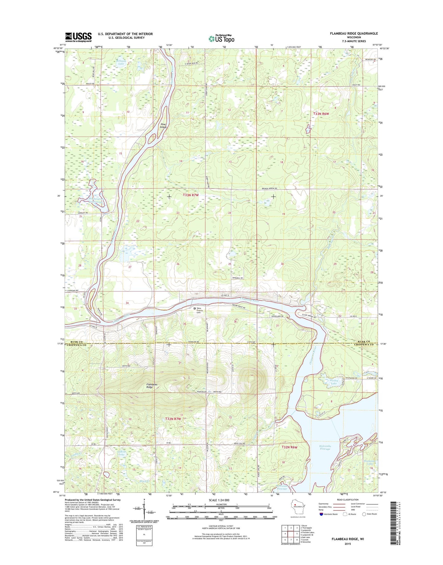
2018 topographic map quadrangle Flambeau Ridge in the state of Wisconsin. Scale: 1:24000. Based on the newly updated USGS 7.5' US Topo map series, this map is in the following counties: Rusk, Chippewa. The map contains contour data, water features, and other items you are used to seeing on USGS maps, but also has updated roads and other features. This is the next generation of topographic maps. Printed on high-quality waterproof paper with UV fade-resistant inks.
Quads adjacent to this one:
West: Fireside Lakes
Northwest: Bruce
North: Thornapple
Northeast: Ladysmith
East: Ladysmith SE
Southeast: Holcombe
South: Cornell
Southwest: Bob Lake
Contains the following named places: Birch Creek School, Birch Creek Townhall, Bollman Lake, Bollman School, Christian Harbor Youth Camp, Deer Tail Creek, Flambeau Lookout Tower, Flambeau Ridge, Flambeau River, Flambeau School, Jump River, La Rose School, LaRose Lake, Pine Island, Plagge Woods State Natural Area, Rivers Edge, Robinson Lake, Saint Francis Cemetery, Saint Francis Church, Sportsman Club Park, Taylor Creek, Town of Washington, Washington Creek Flowage, Washington Creek State Wildlife Management Area, Washington Creek Wildlife Area Dam, Washington Townhall, Wesley Lake