MyTopo
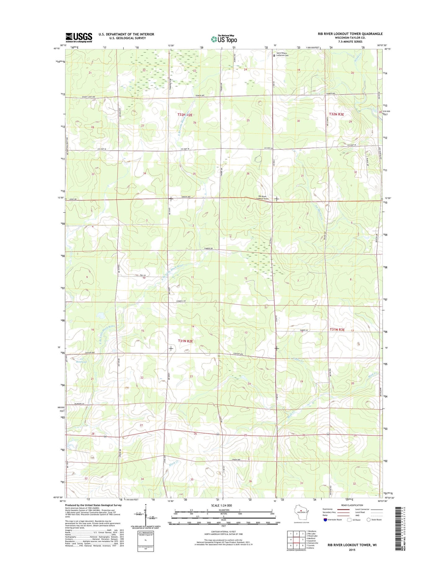
Rib River Lookout Tower Wisconsin US Topo Map
Couldn't load pickup availability
2022 topographic map quadrangle Rib River Lookout Tower in the state of Wisconsin. Scale: 1:24000. Based on the newly updated USGS 7.5' US Topo map series, this map is in the following counties: Taylor. The map contains contour data, water features, and other items you are used to seeing on USGS maps, but also has updated roads and other features. This is the next generation of topographic maps. Printed on high-quality waterproof paper with UV fade-resistant inks.
Quads adjacent to this one:
West: Medford
Northwest: Westboro
North: Rib Lake
Northeast: Wood Lake
East: Goodrich
Southeast: Athens
South: Corinth
Southwest: Stetsonville
This map covers the same area as the classic USGS quad with code o45090b2.
Contains the following named places: 0.1 Reservoir, Birchwood School, Buddy School, Charlies Airport, Cloverdale School, Coffee Creek, Fairfield School, Green Grove School, Greenwood School, Liske H2393 Dam, Rib River Lookout Tower, Saint Peter Church, Saint Peters Lutheran Cemetery, Sunny Knoll School, Town of Browning, Town of Greenwood, Wood Creek, Woodville School