MyTopo
Hancock Wisconsin US Topo Map
Couldn't load pickup availability
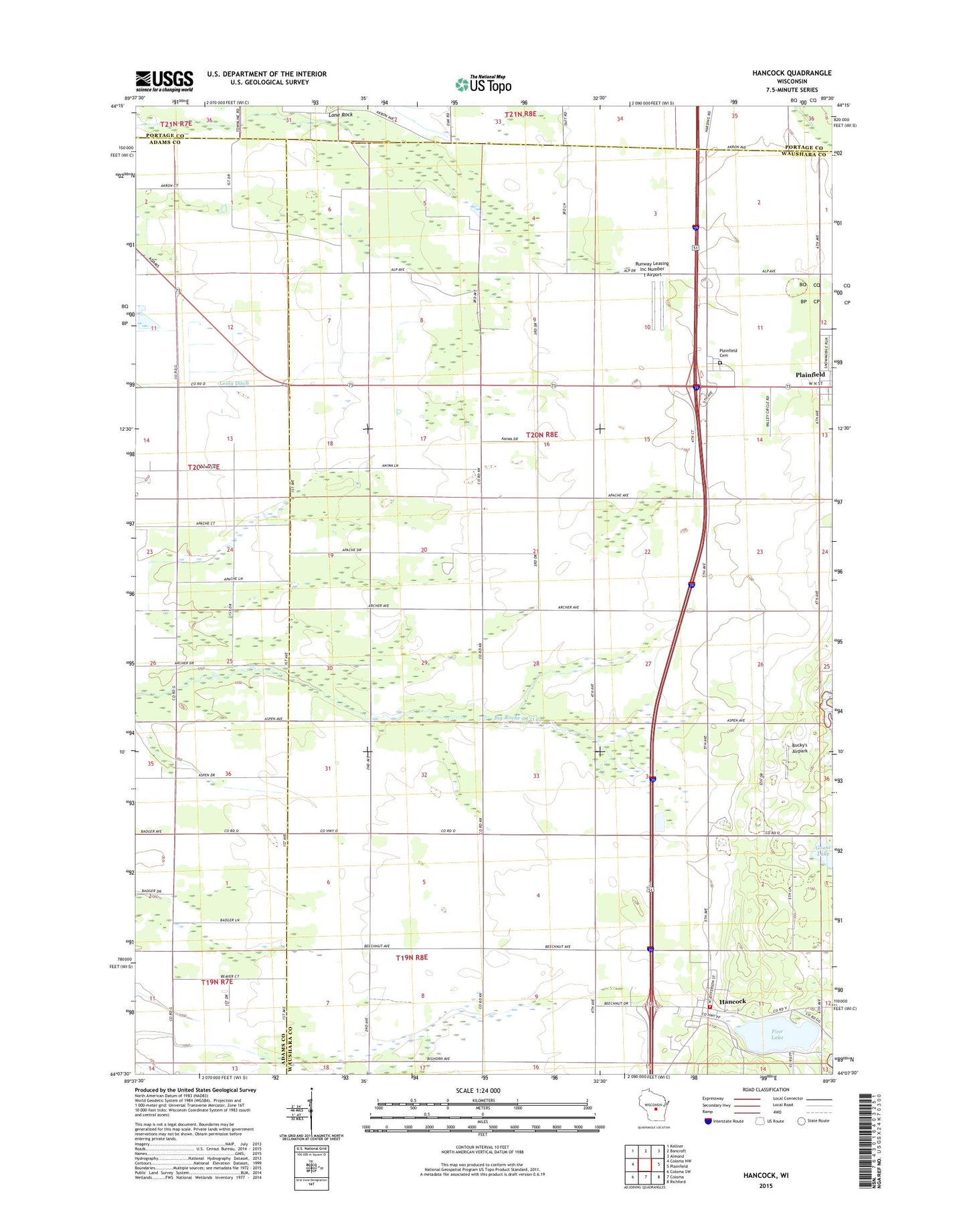
2018 topographic map quadrangle Hancock in the state of Wisconsin. Scale: 1:24000. Based on the newly updated USGS 7.5' US Topo map series, this map is in the following counties: Waushara, Adams, Portage. The map contains contour data, water features, and other items you are used to seeing on USGS maps, but also has updated roads and other features. This is the next generation of topographic maps. Printed on high-quality waterproof paper with UV fade-resistant inks.
Quads adjacent to this one:
West: Coloma NW
Northwest: Kellner
North: Bancroft
Northeast: Almond
East: Plainfield
Southeast: Richford
South: Coloma
Southwest: Coloma SW
Contains the following named places: Bucky's Airpark, Goose Lake, Hancock, Hancock Post Office, Hancock Volunteer Fire Department, Leola Ditch, Pine Lake, Plainfield Cemetery, Pole Bridge School, Rathermel School, Runway Leasing Inc Number 1 Airport, Town of Plainfield, Village of Hancock, ZIP Codes: 54943, 54966