MyTopo
Richford Wisconsin US Topo Map
Couldn't load pickup availability
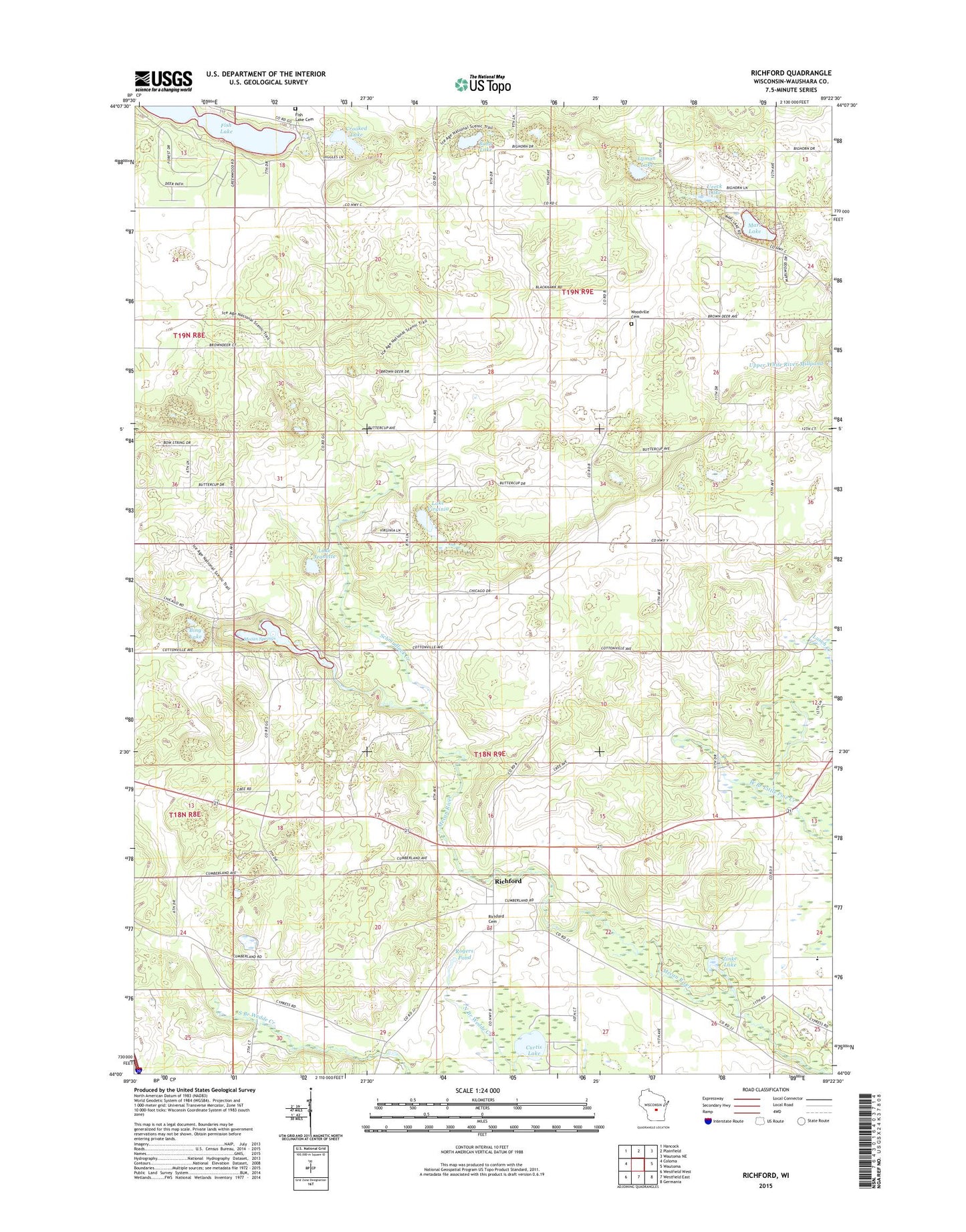
2022 topographic map quadrangle Richford in the state of Wisconsin. Scale: 1:24000. Based on the newly updated USGS 7.5' US Topo map series, this map is in the following counties: Waushara. The map contains contour data, water features, and other items you are used to seeing on USGS maps, but also has updated roads and other features. This is the next generation of topographic maps. Printed on high-quality waterproof paper with UV fade-resistant inks.
Quads adjacent to this one:
West: Coloma
Northwest: Hancock
North: Plainfield
Northeast: Wautoma NE
East: Wautoma
Southeast: Germania
South: Westfield East
Southwest: Westfield West
This map covers the same area as the classic USGS quad with code o44089a4.
Contains the following named places: American Legion Boys Camp, Bing Lake, Bohn Lake, Crooked Lake, Curtis Lake, Fish Lake, Grace Church, Greenwood State Wildlife Refuge, Lake Jeanette, Lake Virginia, Lyman Lake, Marl Lake, Mecan Springs, Mecan Springs State Natural Area, Merriam Boy Scout Camp, Pochman Lake, Potter Church, Richford, Richford Cemetery, Rogers Pond, Round Lake, Schmudlack Creek, Shady Pine School, Town of Deerfield, Town of Richford, Ueeck Lake, Woodville Cemetery, Zinke Lake