MyTopo
Harmony Wisconsin US Topo Map
Couldn't load pickup availability
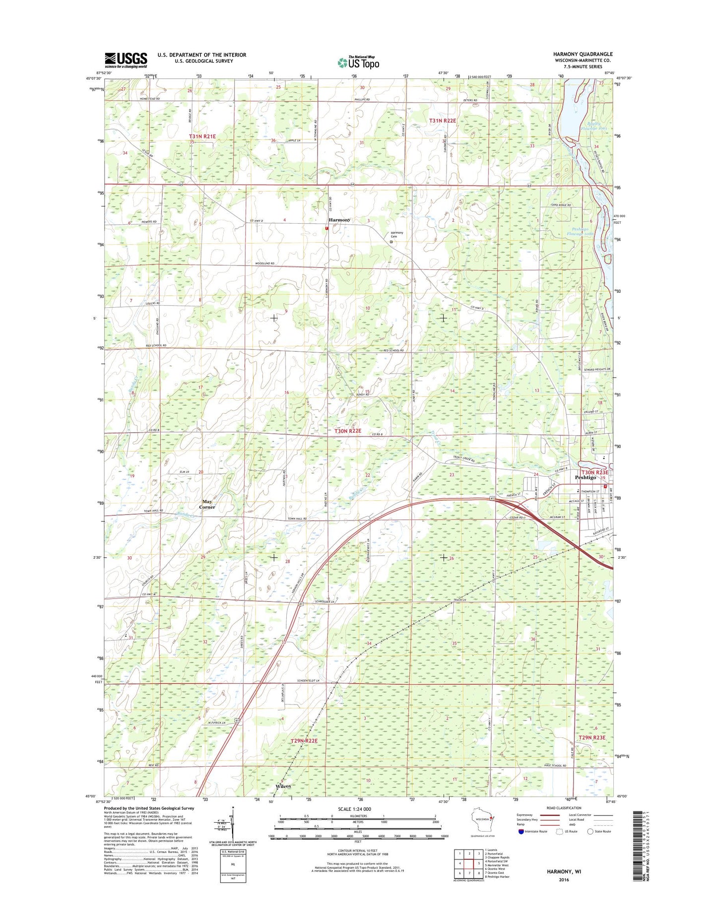
2022 topographic map quadrangle Harmony in the state of Wisconsin. Scale: 1:24000. Based on the newly updated USGS 7.5' US Topo map series, this map is in the following counties: Marinette. The map contains contour data, water features, and other items you are used to seeing on USGS maps, but also has updated roads and other features. This is the next generation of topographic maps. Printed on high-quality waterproof paper with UV fade-resistant inks.
Quads adjacent to this one:
West: Porterfield SW
Northwest: Loomis
North: Porterfield
Northeast: Chappee Rapids
East: Marinette West
Southeast: Peshtigo Harbor
South: Oconto East
Southwest: Oconto West
This map covers the same area as the classic USGS quad with code o45087a7.
Contains the following named places: Bagley Flowage 1061, Bundy Creek, Cedar School, Feifarek School, Grover - Porterfield Fire Department, Hale Road School, Harmony, Harmony Cemetery, Homestead School, Job Place School, Marinette County Farm, May Corner, Peshtigo City Fire Department Station 1, Peshtigo City Hall, Peshtigo Elementary Learning Center, Peshtigo Fire Cemetery, Peshtigo Fire Museum, Peshtigo Lookout Tower, Peshtigo Middle - High School, Peshtigo Police Department, Peshtigo United Methodist Church, Plumb School, Potato Rapids Dam, Potato Rapids WP 133 Dam, Red School, Roosevelt School, Saint John Evangelical Lutheran School, Saint Johns Church, Saint Marys Catholic Church, Saint Thomas Aquinas Academy Elementary Campus, Sandberg School, Town of Grover, Urbaniak Field, WHYB-FM (Peshtigo), Zion Lutheran Church, ZIP Code: 54157