MyTopo
Oconto West Wisconsin US Topo Map
Couldn't load pickup availability
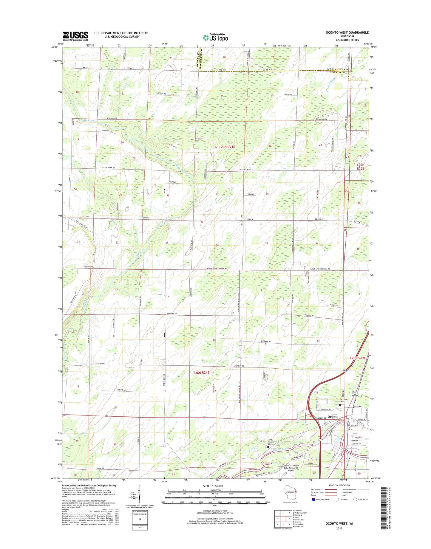
2022 topographic map quadrangle Oconto West in the state of Wisconsin. Scale: 1:24000. Based on the newly updated USGS 7.5' US Topo map series, this map is in the following counties: Oconto, Marinette. The map contains contour data, water features, and other items you are used to seeing on USGS maps, but also has updated roads and other features. This is the next generation of topographic maps. Printed on high-quality waterproof paper with UV fade-resistant inks.
Quads adjacent to this one:
West: Lena
Northwest: Coleman
North: Porterfield SW
Northeast: Harmony
East: Oconto East
Southeast: Oconto SE
South: Pensaukee
Southwest: Abrams
This map covers the same area as the classic USGS quad with code o44087h8.
Contains the following named places: Copper Culture Mounds State Park, Evergreen Cemetery, Fairview School, Holtwood Park, La Follette School, Little River Volunteer Fire Department, Louisville School, Maple Grove School, McDowell School, Oconto Catholic Cemetery, Oconto-J Douglas Bake Municipal Airport, Saint Peters Church, Saint Peters School, Town of Little River, Town of Oconto, Victory School, WOCO-AM (Oconto), WOCO-FM (Oconto), ZIP Code: 54153