MyTopo
Harrison Wisconsin US Topo Map
Couldn't load pickup availability
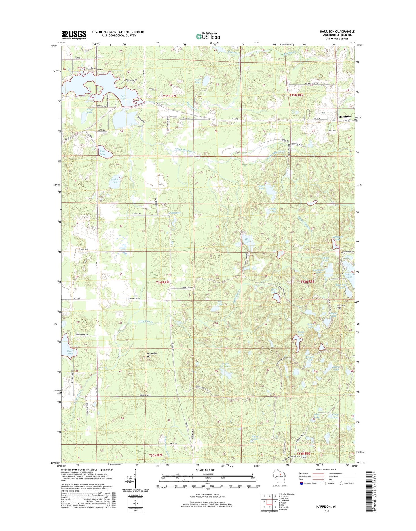
2018 topographic map quadrangle Harrison in the state of Wisconsin. Scale: 1:24000. Based on the newly updated USGS 7.5' US Topo map series, this map is in the following counties: Lincoln. The map contains contour data, water features, and other items you are used to seeing on USGS maps, but also has updated roads and other features. This is the next generation of topographic maps. Printed on high-quality waterproof paper with UV fade-resistant inks.
Quads adjacent to this one:
West: Tomahawk
Northwest: Heafford Junction
North: Woodboro
Northeast: Lake Julia
East: Parrish
Southeast: Gleason
South: Bloomville
Southwest: Irma
Contains the following named places: 2 Reservoir, Ament Lake, Bass Lake, Bear Lake, Beaver Lake, Big Pine Creek, Bruce Lake, Bughouse Lake, Camp Lake, Clover Belt School, Crane Foot Lake, Ebert Lake, Gerbick Lake, Ghost Lake, Green Meadow Creek, Harrison, Harrison Hills, High Lake, Jackknife Lake, Kordick Lake, Lloyd Hilgendorf G-9001 Dam, Lost Lake, Miller Lake, North Branch Pine Creek, Otter Lake, Otter Lake Recreation Area, Perch Lake, Pickerel Creek, Pickerel Lake, Porcupine Mountain, Posey Lake, Roothouse Lake, Silver Lake, Skanawan Townhall, Sump Lake, Tahoe Lake, Town of Skanawan