MyTopo
Hatfield Wisconsin US Topo Map
Couldn't load pickup availability
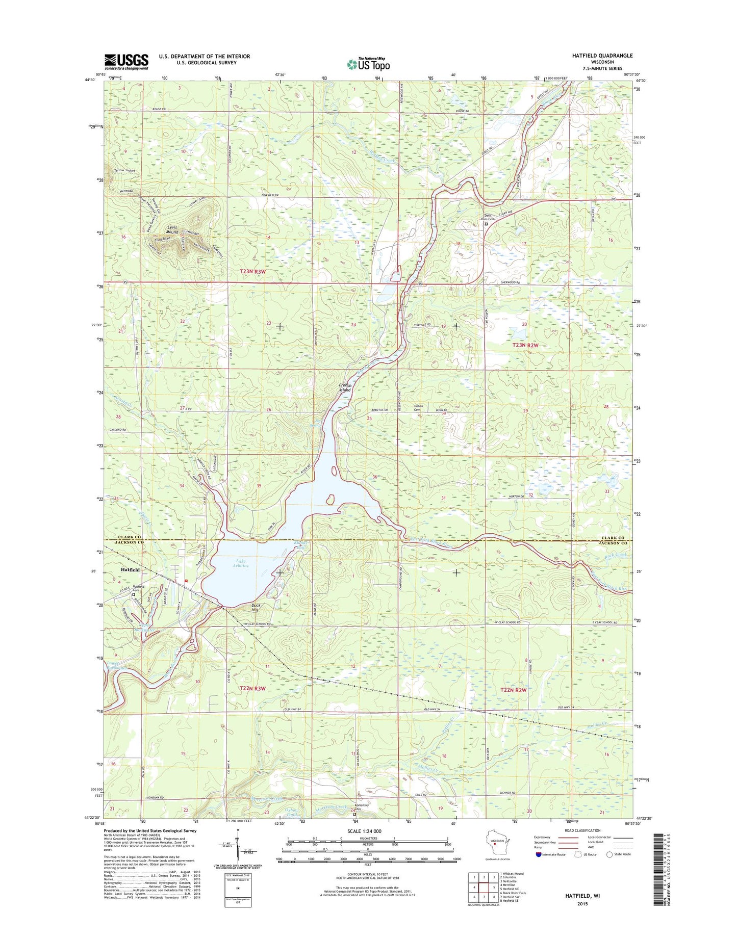
2022 topographic map quadrangle Hatfield in the state of Wisconsin. Scale: 1:24000. Based on the newly updated USGS 7.5' US Topo map series, this map is in the following counties: Clark, Jackson. The map contains contour data, water features, and other items you are used to seeing on USGS maps, but also has updated roads and other features. This is the next generation of topographic maps. Printed on high-quality waterproof paper with UV fade-resistant inks.
Quads adjacent to this one:
West: Merrillan
Northwest: Wildcat Mound
North: Columbia
Northeast: Neillsville
East: Hatfield NE
Southeast: Hatfield SE
South: Hatfield SW
Southwest: Black River Falls
This map covers the same area as the classic USGS quad with code o44090d6.
Contains the following named places: Arnold Creek, Big Spring, Clay, Davis Creek, Dells Dam Cemetery, Dells Dam School, Duck Hill, East Fork Black River, East Fork Recreation Area, French Island, Hatfield, Hatfield Cemetery, Hatfield Census Designated Place, Hatfield Dam, Hatfield Fire and Rescue, Hay Creek, Klimas Bay, Komensky Cemetery, Lake Arbutus, Levis Mound, Mollies Creek, Opelt Sand and Gravel Pit, Pineview School, Pollies Creek, Rock Creek, Russell Memorial Park, Town of Dewhurst, Town of Komensky, Upper Backwater, Wedges Creek, Winnebago Indian Cemetery