MyTopo
Merrillan Wisconsin US Topo Map
Couldn't load pickup availability
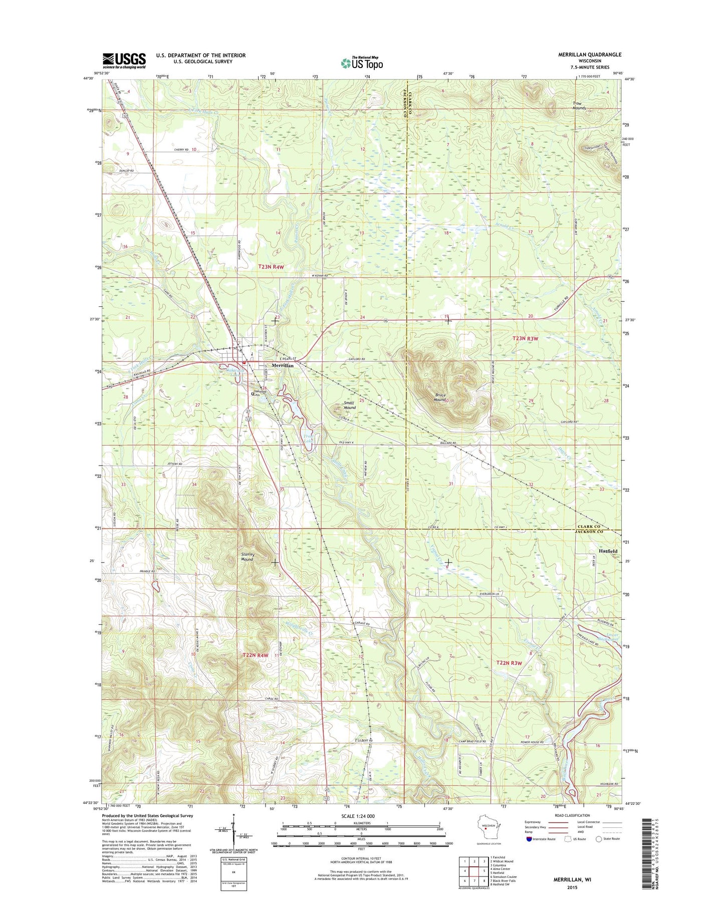
2022 topographic map quadrangle Merrillan in the state of Wisconsin. Scale: 1:24000. Based on the newly updated USGS 7.5' US Topo map series, this map is in the following counties: Jackson, Clark. The map contains contour data, water features, and other items you are used to seeing on USGS maps, but also has updated roads and other features. This is the next generation of topographic maps. Printed on high-quality waterproof paper with UV fade-resistant inks.
Quads adjacent to this one:
West: Alma Center
Northwest: Fairchild
North: Wildcat Mound
Northeast: Columbia
East: Hatfield
Southeast: Hatfield SW
South: Black River Falls
Southwest: Stenulson Coulee
This map covers the same area as the classic USGS quad with code o44090d7.
Contains the following named places: Avon School, Bruce Mound, Bruce Mound School, Camp Bradfield, Cisna Creek, East Fork Halls Creek, Gile Memorial Park, Hatfield School, Lincoln Elementary School, Lower Backwater, Merillan Mills Dam, Merrillan, Merrillan Fire and EMS Department, Merrillan Police Department, Merrillan Post Office, Oakwood Cemetery, Oakwood Lake, Paines Creek, Small Mound, South Fork Halls Creek, Stanley Mound, Town of Alma, Trow, Trow Lake, Trow Mounds, Trows 2WP481 Dam, Village of Merrillan, Vismal Creek, Wright Station, Wrightsville, Wrightsville Creek, Wrightsville Post Office, Wrightsville School, ZIP Code: 54754