MyTopo
Hatfield SE Wisconsin US Topo Map
Couldn't load pickup availability
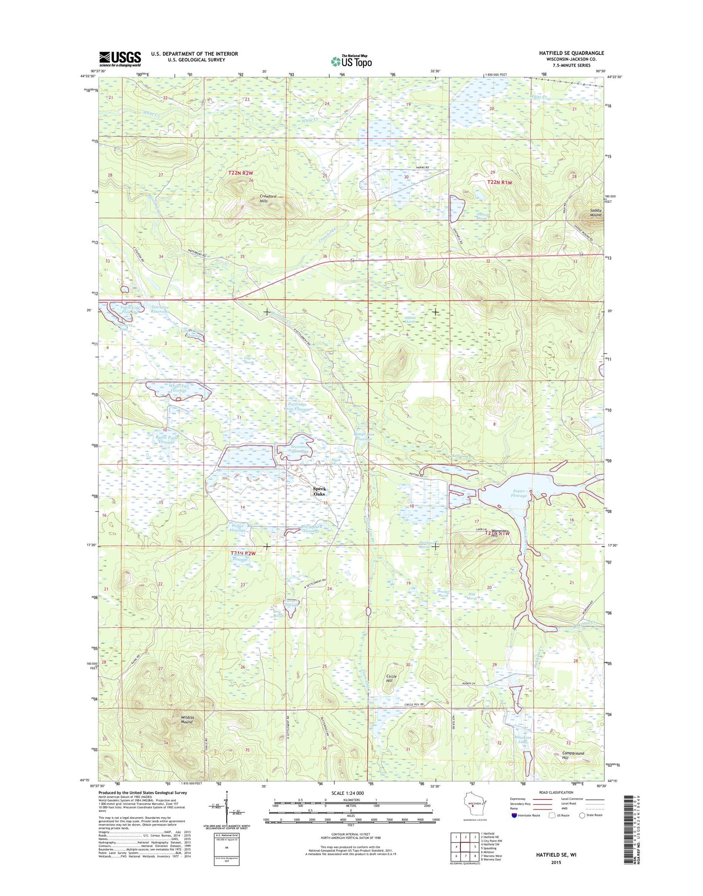
2022 topographic map quadrangle Hatfield SE in the state of Wisconsin. Scale: 1:24000. Based on the newly updated USGS 7.5' US Topo map series, this map is in the following counties: Jackson. The map contains contour data, water features, and other items you are used to seeing on USGS maps, but also has updated roads and other features. This is the next generation of topographic maps. Printed on high-quality waterproof paper with UV fade-resistant inks.
Quads adjacent to this one:
West: Hatfield SW
Northwest: Hatfield
North: Hatfield NE
Northeast: City Point NW
East: Spaulding
Southeast: Warrens East
South: Warrens West
Southwest: Millston
This map covers the same area as the classic USGS quad with code o44090c5.
Contains the following named places: Battle Point Flowage, Black Duck Flowage, Campground Hill, Circle Hill, City Marsh, Crawford Creek, Crawford Hills, Dresher Marsh, Hawkins Creek, Hawkins Lake, Hay Marsh, Johnson Marsh, Little Thunder Flowage, Mallard Flowage, Martin Marsh, McKenna Creek, Normington E7395 Dam, Partridge Crop Flowage, Potter 2WP695 Dam, Potter Flowage, Purrleburg Marsh, Range Line Flowage, Resettlement Administration 12 Dam, Resettlement Administration 15 Dam, Resettlement Administration 2 Dam, Resettlement Administration 4 Dam, Resettlement Administration 5 Dam, Resettlement Administration 6 Dam, Resettlement Administration 8 Dam, Resettlement Administration 8 East Dam, Resettlement Administration 9 Dam, Ring Marsh, Saddle Mound, Schwartz Pool, Seventeen Flowage, Speck Marsh, Speck Oaks, Tanner Flowage, Town Line Creek, Town Line Flowage, Townline Reservoir, Wangreen Hill, Weber Flowage, White Tail Flowage, Whitetail Flowage 12, Wildcat Mound