MyTopo
Haugen Wisconsin US Topo Map
Couldn't load pickup availability
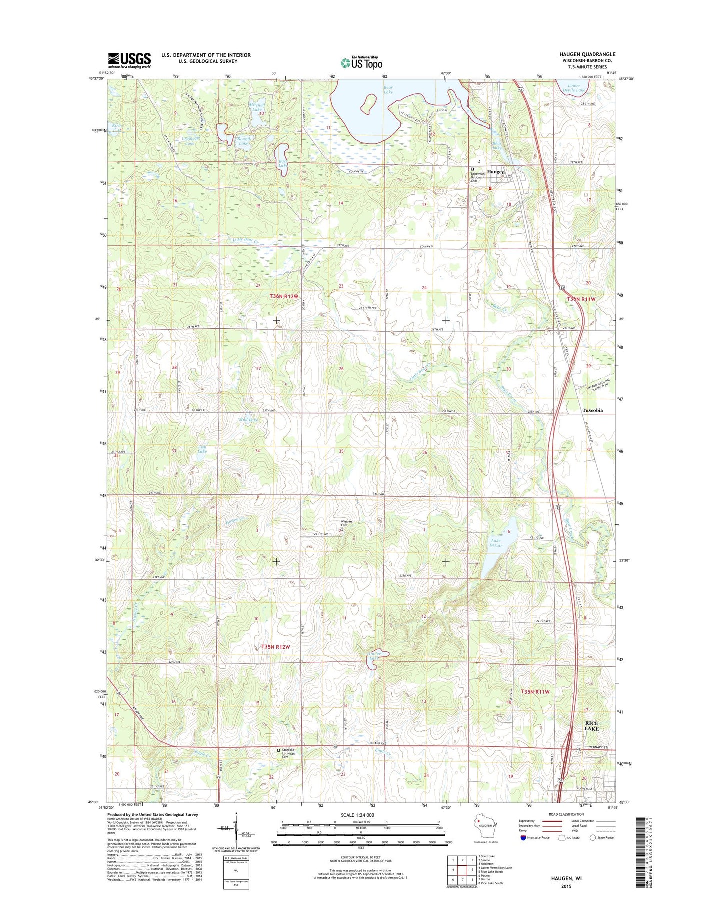
2022 topographic map quadrangle Haugen in the state of Wisconsin. Scale: 1:24000. Based on the newly updated USGS 7.5' US Topo map series, this map is in the following counties: Barron. The map contains contour data, water features, and other items you are used to seeing on USGS maps, but also has updated roads and other features. This is the next generation of topographic maps. Printed on high-quality waterproof paper with UV fade-resistant inks.
Quads adjacent to this one:
West: Lower Vermillion Lake
Northwest: Shell Lake
North: Sarona
Northeast: Nobleton
East: Rice Lake North
Southeast: Rice Lake South
South: Barron
Southwest: Poskin
This map covers the same area as the classic USGS quad with code o45091e7.
Contains the following named places: Bass Lake, Bear Lake - Haugen Fire Department, Bear Lake 60, Bear Lake Sedge Meadow State Natural Area, Bear Lake Townhall, Bear Lake WP11 Dam, Bohemian National Cemetery, Camp Phillips, Crooked Lake, First United Methodist Church, Fish Lake, Friends of Miesner Community Chapel, Ginder Lake, Haugen, Haugen Area Historical Museum, Haugen Elementary School, Haugen Post Office, Haugen Sewage Treatment Facilities, Haugen Village Hall, Haugen Water Tower, Hickey Creek State Public Fishery Area, Holy Trinity Catholic Church, Kirby Lake, Lake Desair, Little Bear Creek, Little Bear Creek Dam, Mitchell Lake, Mud Lake, Rice Lake - Marshfield Medical Center, Round Lake, Stanfold Lutheran Cemetery, Stanfold Lutheran Church, Stanfold Townhall, Town of Bear Lake, Town of Stanfold, Tuscobia, Village of Haugen, WAQE-FM (Rice Lake), Wiesner Cemetery, WJMC Radio Station, WJMC-AM (Rice Lake), WJMC-FM (Rice Lake), WMYD-AM (Rice Lake), ZIP Code: 54841