MyTopo
Nobleton Wisconsin US Topo Map
Couldn't load pickup availability
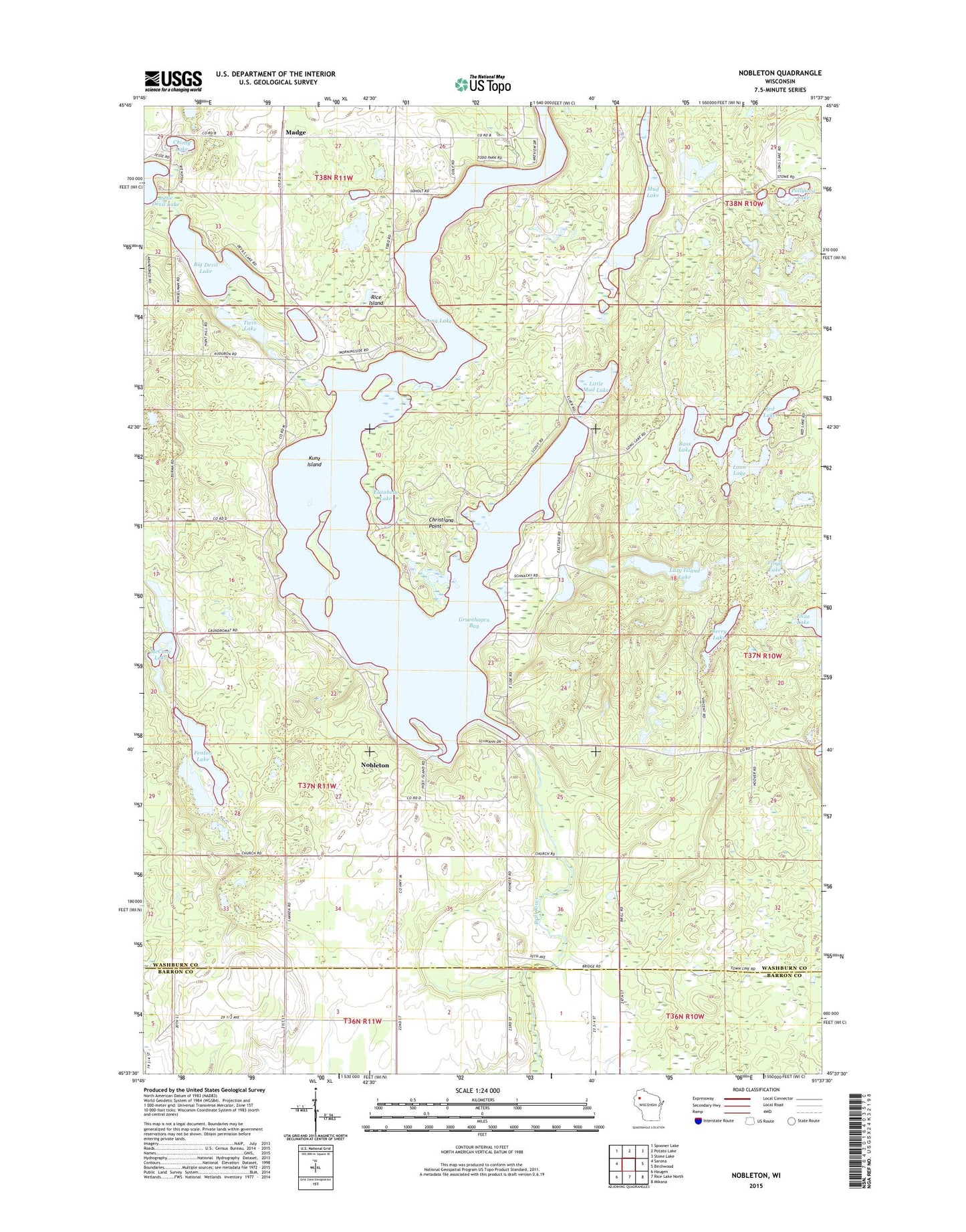
2022 topographic map quadrangle Nobleton in the state of Wisconsin. Scale: 1:24000. Based on the newly updated USGS 7.5' US Topo map series, this map is in the following counties: Washburn, Barron. The map contains contour data, water features, and other items you are used to seeing on USGS maps, but also has updated roads and other features. This is the next generation of topographic maps. Printed on high-quality waterproof paper with UV fade-resistant inks.
Quads adjacent to this one:
West: Sarona
Northwest: Spooner Lake
North: Potato Lake
Northeast: Stone Lake
East: Birchwood
Southeast: Mikana
South: Rice Lake North
Southwest: Haugen
This map covers the same area as the classic USGS quad with code o45091f6.
Contains the following named places: Bass Lake, Berry Lake, Big Devil Lake, Chinty Lake, Christiana Point, Dory's Bog and Hunt Hill State Natural Area, Drew 9 Airport, Eliza Lake, Elizabeth Lake, Evergreen Chapel, Fenton Lake, Floyd Lake, Gruenhagen Bay, Kunz Island, Lazy Island Lake, Little Devil Lake, Little Mud Lake, Long Lake, Long Lake 82, Long Lake Church, Long Lake Dam, Long Lake Townhall, Loon Lake, Madge, McCune Lake, Mud Lake, Nobleton, Pollywog Lake, Red Lake, Rice Island, Tomahawk Scout Reservation, Town of Long Lake, Twin Lake, WAQE-FM (Rice Lake)