MyTopo
Lake Tomahawk Wisconsin US Topo Map
Couldn't load pickup availability
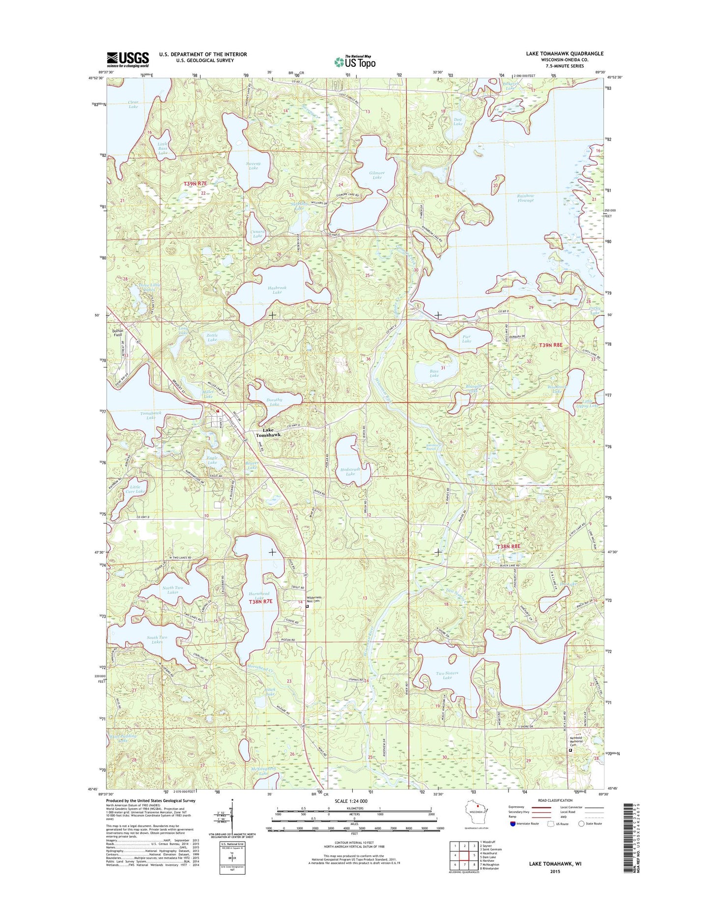
2022 topographic map quadrangle Lake Tomahawk in the state of Wisconsin. Scale: 1:24000. Based on the newly updated USGS 7.5' US Topo map series, this map is in the following counties: Oneida. The map contains contour data, water features, and other items you are used to seeing on USGS maps, but also has updated roads and other features. This is the next generation of topographic maps. Printed on high-quality waterproof paper with UV fade-resistant inks.
Quads adjacent to this one:
West: Hazelhurst
Northwest: Woodruff
North: Sayner
Northeast: Saint Germain
East: Dam Lake
Southeast: Rhinelander
South: McNaughton
Southwest: Harshaw
This map covers the same area as the classic USGS quad with code o45089g5.
Contains the following named places: Bass Lake, Beaver Lake, Black Lake School, Bluegill Lake, Clear Lake, Corky Lake, Cunard Lake, D L Lake, Dog Lake, Dolhun Field, Dorothy Lake, Eagle Lake, Gilmore Creek, Gilmore Lake, Hasbrook Creek, Hasbrook Lake, Hawk Lake, Hodstradt Lake, Horsehead Creek, Horsehead Lake, Lake Tomahawk, Lake Tomahawk Census Designated Place, Lake Tomahawk Lookout Tower, Lake Tomahawk Post Office, Lake Tomahawk Volunteer Fire Department, Little Bass Lake, Little Carr Lake, Little Gypsy Lake, Long Lake, Miller Lake, Newbold Memorial Cemetery, North Two Lakes, Pickerel Canal 2WP185 Dam, Pickerel Control 2WP185 Dam, Pickerel Lake, Pier Lake, Rainbow Flowage, Rainbow Flowage 740, Rainbow Rapids, Rainbow Reservoir 2WP185 Dam, South Two Lakes, Sureshot Lake, Swamp Creek, Sweeny Creek, Sweeny Lake, Three Little Lakes, Town of Lake Tomahawk, Town of Woodruff, Two Sisters Creek, Two Sisters Lake, Wilderness Rest Cemetery, Woodcock Lake, Zottle Lake, ZIP Code: 54539