MyTopo
Palmyra Wisconsin US Topo Map
Couldn't load pickup availability
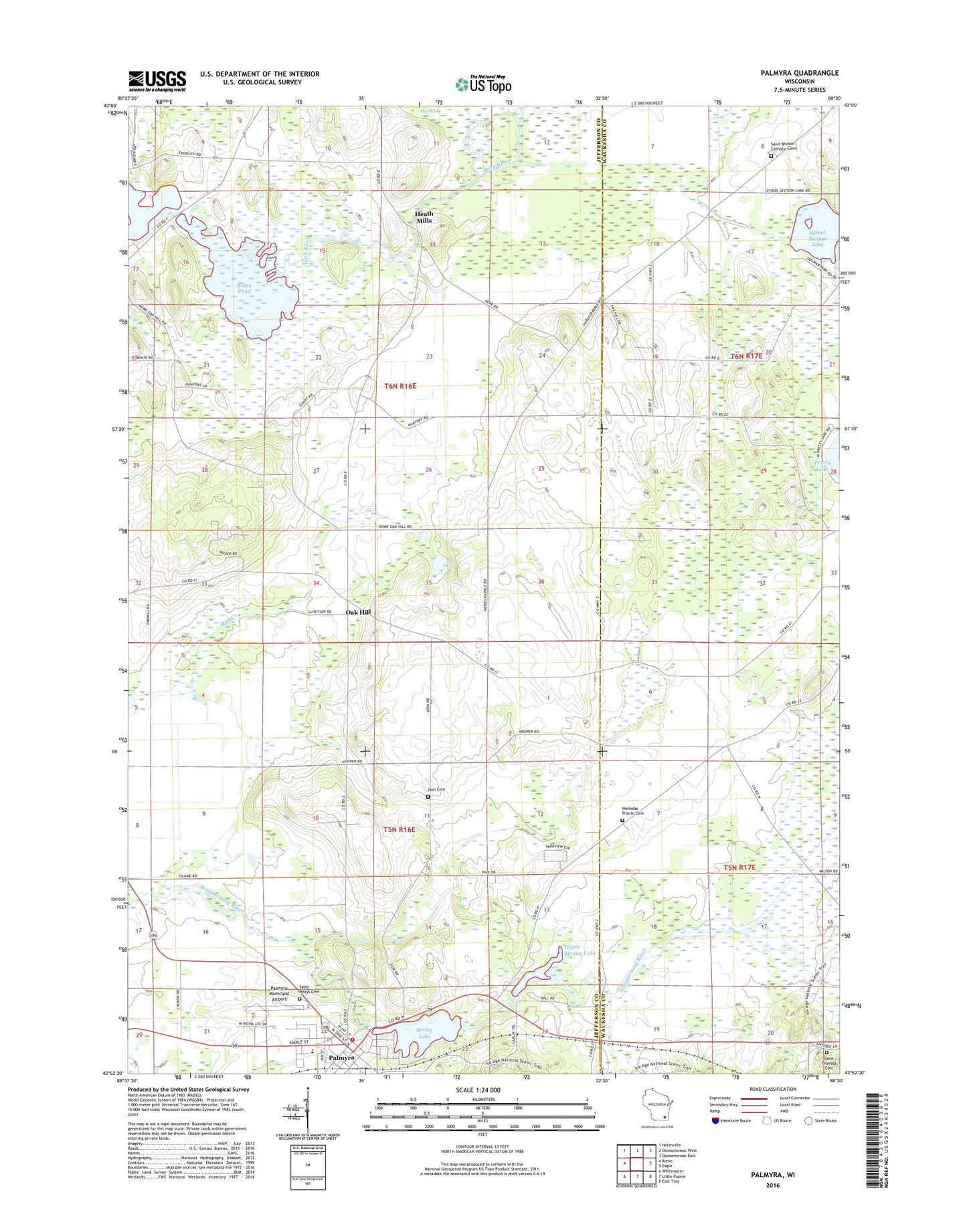
2022 topographic map quadrangle Palmyra in the state of Wisconsin. Scale: 1:24000. Based on the newly updated USGS 7.5' US Topo map series, this map is in the following counties: Jefferson, Waukesha. The map contains contour data, water features, and other items you are used to seeing on USGS maps, but also has updated roads and other features. This is the next generation of topographic maps. Printed on high-quality waterproof paper with UV fade-resistant inks.
Quads adjacent to this one:
West: Rome
Northwest: Helenville
North: Oconomowoc West
Northeast: Oconomowoc East
East: Eagle
Southeast: East Troy
South: Little Prairie
Southwest: Whitewater
This map covers the same area as the classic USGS quad with code o42088h5.
Contains the following named places: Beaver Dam Lake, Carlin Dam, Hardscrabble Cemetery, Heath Mills, Melendys Prairie Cemetery, Oak Hill, Palmyra, Palmyra Elementary School, Palmyra Fire and Rescue Department, Palmyra Municipal Airport, Palmyra Police Department, Palmyra Post Office, Palmyra Wastewater Treatment Plant, Pleasant Valley Cemetery, Pleasant Valley Church, Rome Pond, Saint Bruno Parish Cemetery, Saint Brunos Church, Saint Marys Cemetery, Saint Theresa Cemetery, School Section Lake, School Section Lake 2WP284 Dam, Scuppernong Prairie State Natural Area, Siloam Chapel, Spring Lake, Spring Lake 38, Spring Lake E18.2 Dam, Town of Palmyra, Town of Sullivan, Upper Spring Lake, Village of Palmyra, Zion Cemetery, ZIP Code: 53156