MyTopo
Hertel Wisconsin US Topo Map
Couldn't load pickup availability
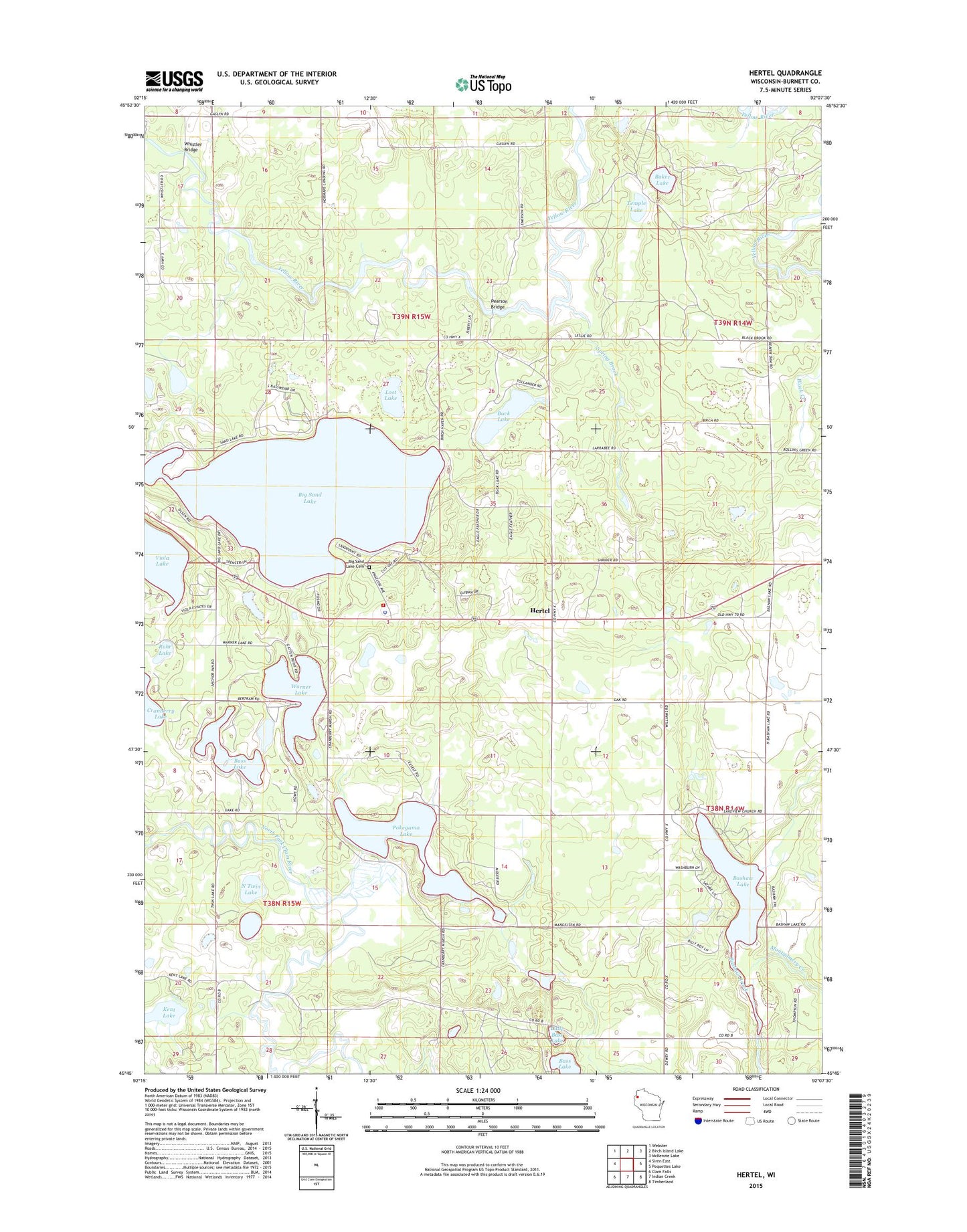
2018 topographic map quadrangle Hertel in the state of Wisconsin. Scale: 1:24000. Based on the newly updated USGS 7.5' US Topo map series, this map is in the following counties: Burnett. The map contains contour data, water features, and other items you are used to seeing on USGS maps, but also has updated roads and other features. This is the next generation of topographic maps. Printed on high-quality waterproof paper with UV fade-resistant inks.
Quads adjacent to this one:
West: Siren East
Northwest: Webster
North: Birch Island Lake
Northeast: McKenzie Lake
East: Poquettes Lake
Southeast: Timberland
South: Indian Creek
Southwest: Clam Falls
Contains the following named places: Baker Lake, Bashaw Brook, Bashaw Lake, Bass Lake, Big Sand Lake, Big Sand Lake Cemetery, Buck Lake, Doran School, Hertel, Kent Lake, Lakeview United Methodist Church, Little Bass Lake, Lost Lake, Montgomery Creek, North Twin Lake, Pearson Bridge, Pokegama Lake, Rohr Lake, Saint Croix Tribal Hertel Fire Department, Saint Croix Tribal Police Department, South Twin Lake, Spring Brook, Spring Brook Springs State Fishery Area, Temple Lake, Town of La Follette, Town of Sand Lake, Twin Lakes, Warner Lake, Whistler Bridge, White Pine School, ZIP Code: 54845