MyTopo
Timberland Wisconsin US Topo Map
Couldn't load pickup availability
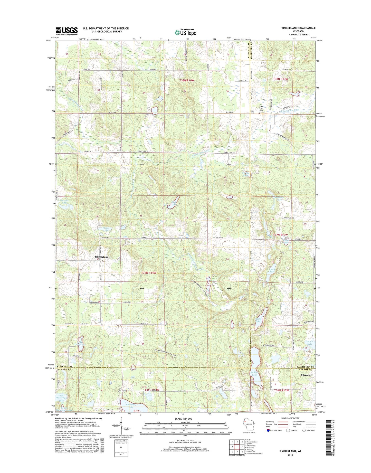
2022 topographic map quadrangle Timberland in the state of Wisconsin. Scale: 1:24000. Based on the newly updated USGS 7.5' US Topo map series, this map is in the following counties: Burnett, Washburn, Barron. The map contains contour data, water features, and other items you are used to seeing on USGS maps, but also has updated roads and other features. This is the next generation of topographic maps. Printed on high-quality waterproof paper with UV fade-resistant inks.
Quads adjacent to this one:
West: Indian Creek
Northwest: Hertel
North: Poquettes Lake
Northeast: Spooner
East: Shell Lake
Southeast: Lower Vermillion Lake
South: Cumberland
Southwest: McKinley
This map covers the same area as the classic USGS quad with code o45092f1.
Contains the following named places: Buck Lake, Chain Lake, Church of God, Clam River Cemetery, Clam River State Fishery Area, Horseshoe Lake, Kinny Lake, Lake Thirty Two, Leach Lake, Offers Lake, Peacock Lake, Places Lake, Roosevelt School, Roosevelt Townhall, Severson Lake, Shallow Lake, South Dewey Community Church, South Dewey School, South Fork Clam River, Spring Lake, Timberland, Timberland Church, Town of Roosevelt, Upper Waterman Lake, ZIP Codes: 54813, 54871