MyTopo
Hewitt Wisconsin US Topo Map
Couldn't load pickup availability
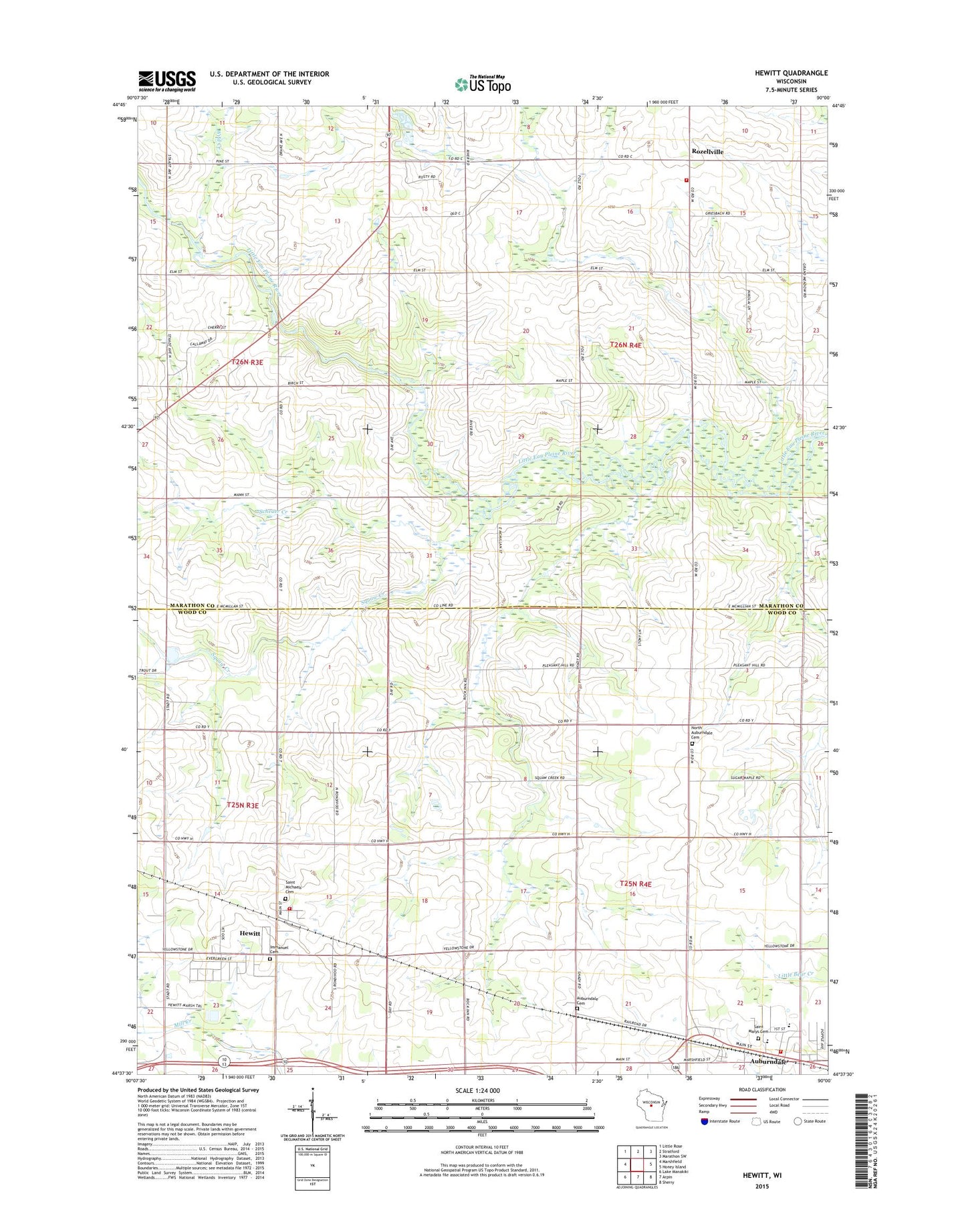
2018 topographic map quadrangle Hewitt in the state of Wisconsin. Scale: 1:24000. Based on the newly updated USGS 7.5' US Topo map series, this map is in the following counties: Marathon, Wood. The map contains contour data, water features, and other items you are used to seeing on USGS maps, but also has updated roads and other features. This is the next generation of topographic maps. Printed on high-quality waterproof paper with UV fade-resistant inks.
Quads adjacent to this one:
West: Marshfield
Northwest: Little Rose
North: Stratford
Northeast: Marathon SW
East: Honey Island
Southeast: Sherry
South: Arpin
Southwest: Lake Manakiki
Contains the following named places: Auburndale, Auburndale Cemetery, Auburndale Elementary School, Auburndale High School, Auburndale Joint Fire Department, Auburndale Post Office, Dodge School, Evergreen Hill School, Hewitt, Hewitt Area Fire Department, Hillside School, Immanuel Lutheran Cemetery, Immanuel Lutheran Church, North Auburndale Cemetery, Pleasant Hill School, Riverside School, Rozellville, Saint Johns Lutheran Church, Saint Mary Grade School, Saint Marys Catholic Cemetery, Saint Marys Catholic Church, Saint Michaels Catholic Church, Saint Michaels Cemetery, Scheuer Creek, Squaw Creek, Stratford Area Fire Department Station 2, Town of Auburndale, Town of Day, Village of Auburndale, Village of Hewitt, White Oak School, Wild Creek, ZIP Code: 54441