MyTopo
Sherry Wisconsin US Topo Map
Couldn't load pickup availability
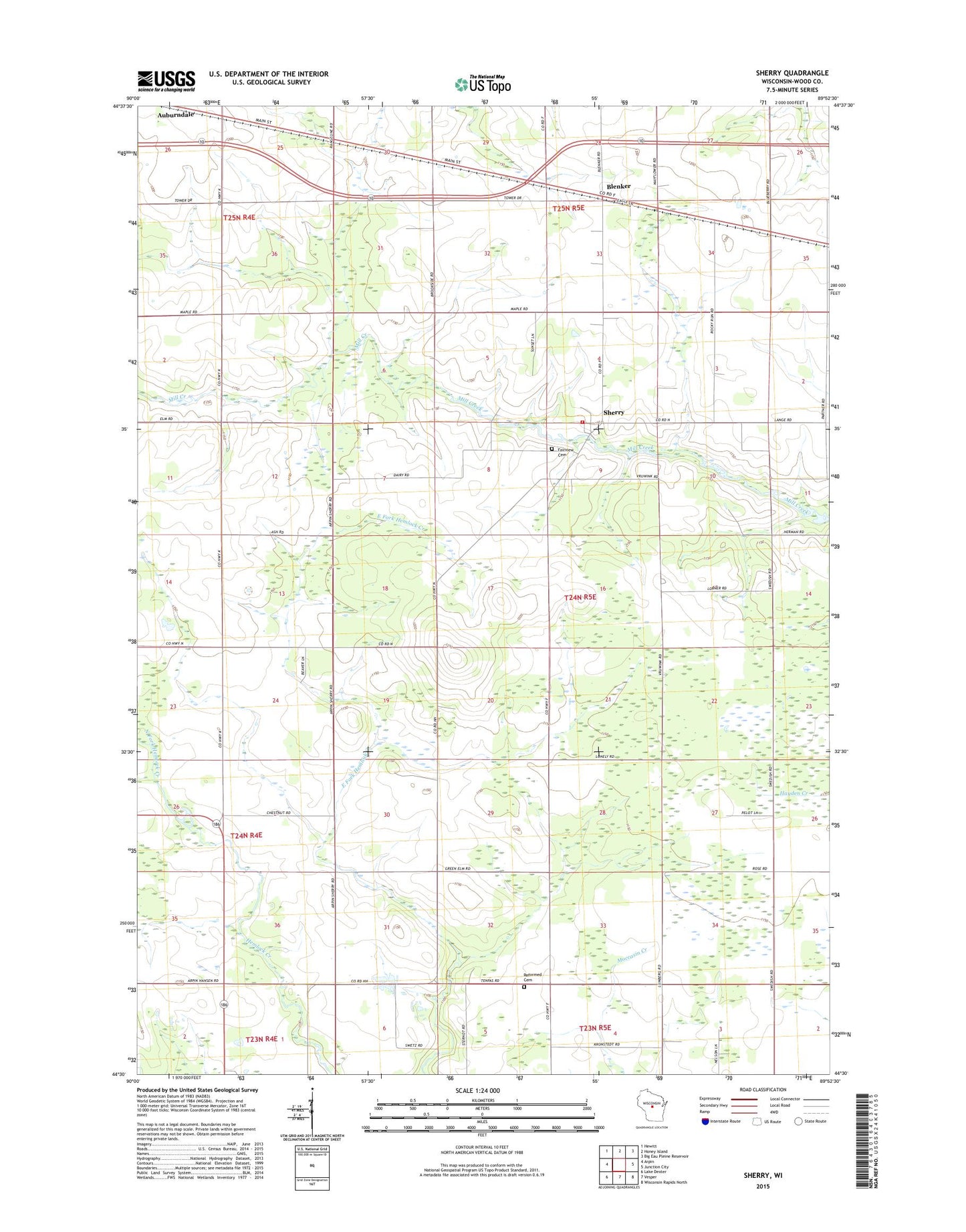
2022 topographic map quadrangle Sherry in the state of Wisconsin. Scale: 1:24000. Based on the newly updated USGS 7.5' US Topo map series, this map is in the following counties: Wood. The map contains contour data, water features, and other items you are used to seeing on USGS maps, but also has updated roads and other features. This is the next generation of topographic maps. Printed on high-quality waterproof paper with UV fade-resistant inks.
Quads adjacent to this one:
West: Arpin
Northwest: Hewitt
North: Honey Island
Northeast: Big Eau Pleine Reservoir
East: Junction City
Southeast: Wisconsin Rapids North
South: Vesper
Southwest: Lake Dexter
This map covers the same area as the classic USGS quad with code o44089e8.
Contains the following named places: Blenker, Blenker Post Office, Blenker School, Christian Reformed Cemetery, Clovernook School, Crescent School, Fairview Cemetery, Green Elm School, Meadowbrook School, North Fork Hemlock Creek, Reformed Church, Sherry, Sherry Volunteer Fire Department, Town of Sherry, ZIP Code: 54454