MyTopo
Arpin Wisconsin US Topo Map
Couldn't load pickup availability
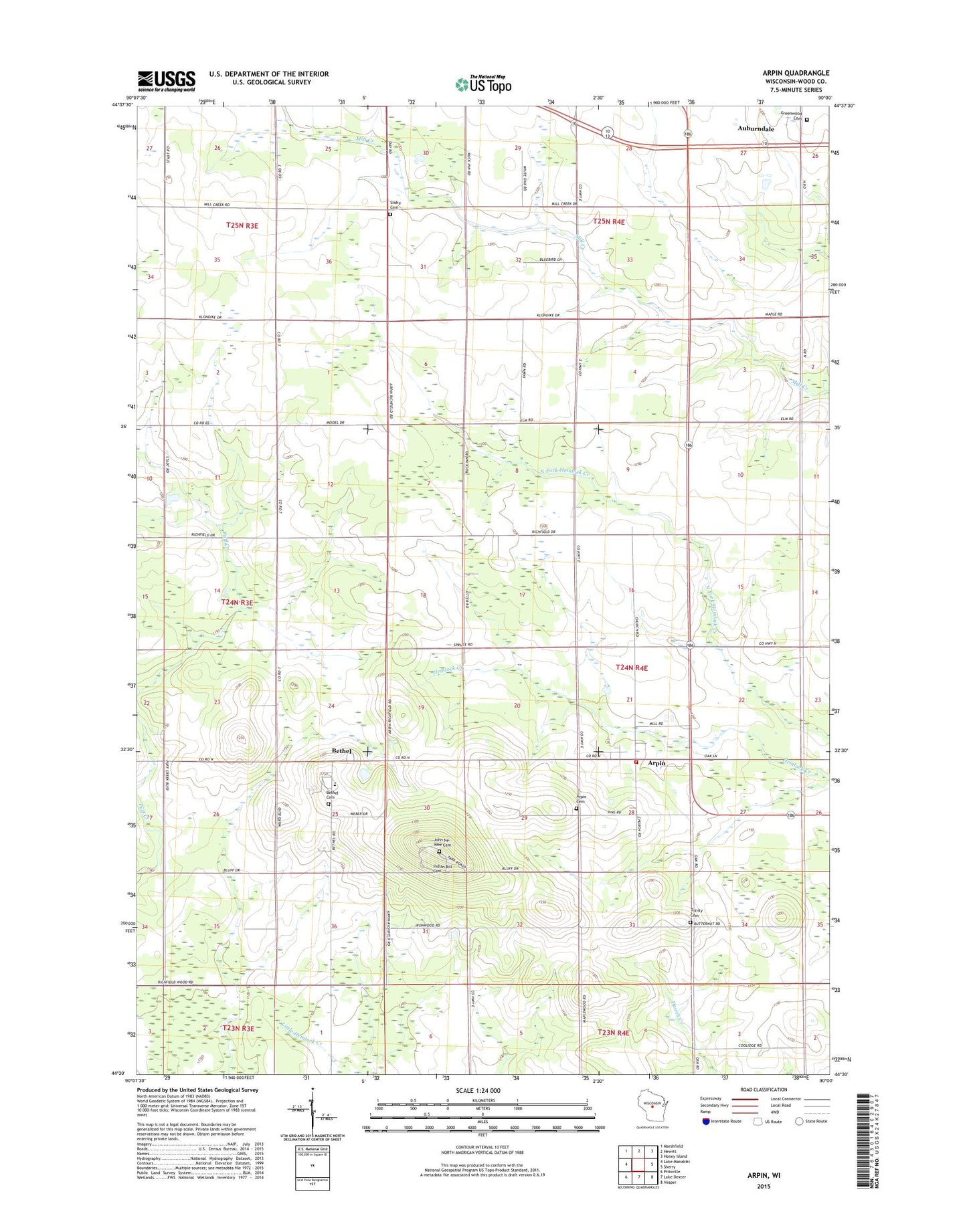
2022 topographic map quadrangle Arpin in the state of Wisconsin. Scale: 1:24000. Based on the newly updated USGS 7.5' US Topo map series, this map is in the following counties: Wood. The map contains contour data, water features, and other items you are used to seeing on USGS maps, but also has updated roads and other features. This is the next generation of topographic maps. Printed on high-quality waterproof paper with UV fade-resistant inks.
Quads adjacent to this one:
West: Lake Manakiki
Northwest: Marshfield
North: Hewitt
Northeast: Honey Island
East: Sherry
Southeast: Vesper
South: Lake Dexter
Southwest: Pittsville
This map covers the same area as the classic USGS quad with code o44090e1.
Contains the following named places: Arpin, Arpin Cemetery, Arpin Post Office, Arpin School, Arpin Volunteer Fire Department, Berryland Farm, Bethel, Bethel Cemetery, Bethel Junior Academy, Emmanuel Lutheran Cemetery, Greenwood Cemetery, Indian Bill Cemetery, John Na - Wee Cemetery, Kandy Kane Park, Maple Grove School, Mill Creek Grove School, North Arpin Church, North Arpin School, Powers Bluff County Park, Powers Bluff Maple Woods State Natural Area, Shady Nook School, Slidre Cemetery, Town of Arpin, Town of Marshfield, Village of Arpin, WLBL-AM (Auburndale), Woodland Echo School, ZIP Code: 54410