MyTopo
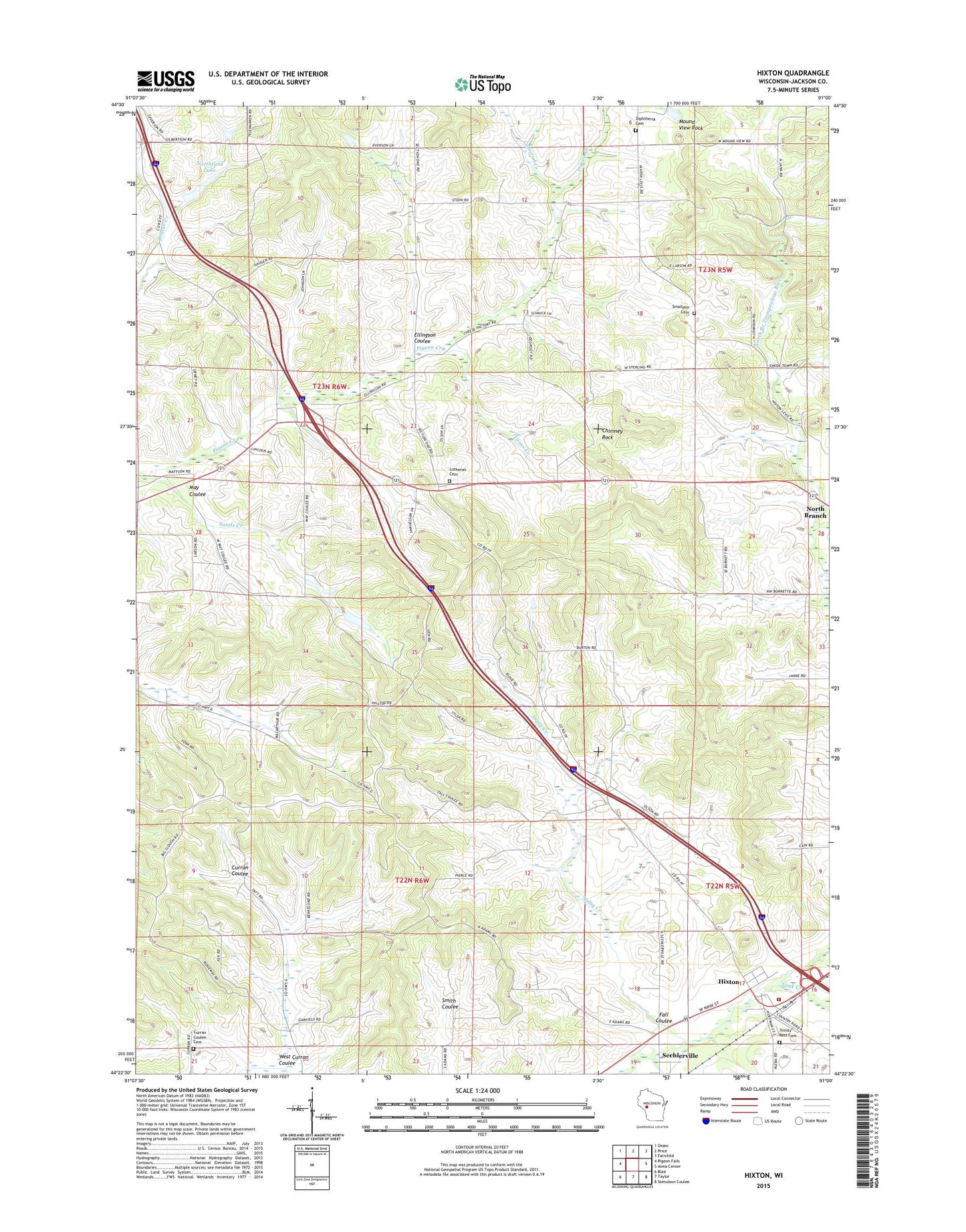
Hixton Wisconsin US Topo Map
Couldn't load pickup availability
2022 topographic map quadrangle Hixton in the state of Wisconsin. Scale: 1:24000. Based on the newly updated USGS 7.5' US Topo map series, this map is in the following counties: Jackson. The map contains contour data, water features, and other items you are used to seeing on USGS maps, but also has updated roads and other features. This is the next generation of topographic maps. Printed on high-quality waterproof paper with UV fade-resistant inks.
Quads adjacent to this one:
West: Pigeon Falls
Northwest: Osseo
North: Price
Northeast: Fairchild
East: Alma Center
Southeast: Stenulson Coulee
South: Taylor
Southwest: Blair
This map covers the same area as the classic USGS quad with code o44091d1.
Contains the following named places: Beaver Creek Dam, Burton School, Cain's Orchard, Chimney Rock, Chimney Rock School, Curran Valley Cemetery, Curran Valley School, Diphtheria Cemetery, Ellingson Coulee, Ellingson School, Fall Coulee, Gomsrud Creek, Hillside School, Hixton, Hixton Elementary School, Hixton Post Office, Hixton Volunteer Fire Department, Holen School, Holmes Creek, Lyons Creek, Marantha Discipleship Center H1240 Dam, May Coulee, Mound View Rock, Napstad School, Northfield, Northfield Lake, Northfield School, Sands Creek, Small Pox Cemetery, Spring Creek Farms, Stony Creek, Tank Creek, Town of Curran, Town of Northfield, Trinity Rest Cemetery, Upper Pigeon Creek Church, Upper Pigeon Creek Lutheran Cemetery, Village of Hixton, West Curran Coulee, ZIP Code: 54635