MyTopo
Taylor Wisconsin US Topo Map
Couldn't load pickup availability
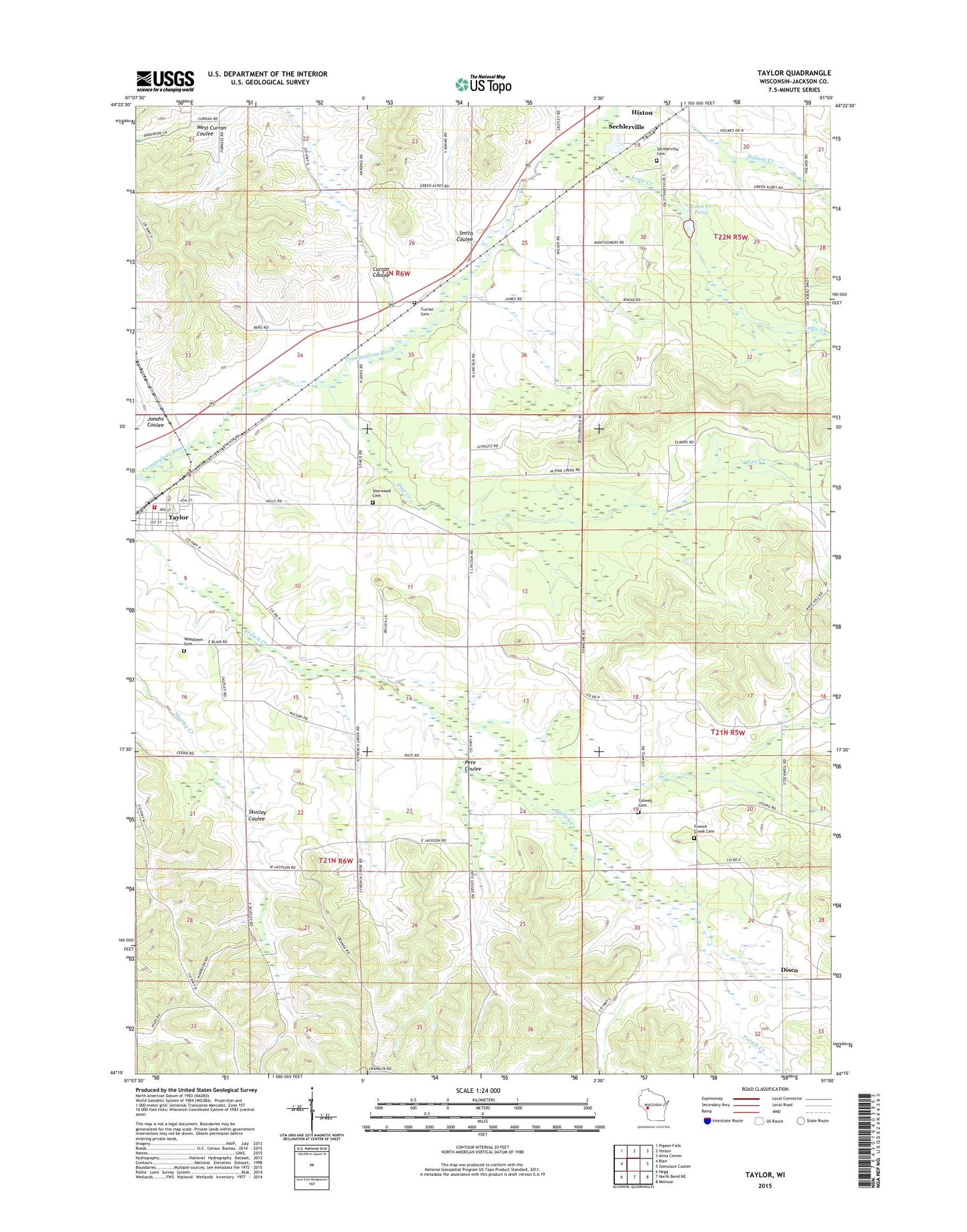
2022 topographic map quadrangle Taylor in the state of Wisconsin. Scale: 1:24000. Based on the newly updated USGS 7.5' US Topo map series, this map is in the following counties: Jackson. The map contains contour data, water features, and other items you are used to seeing on USGS maps, but also has updated roads and other features. This is the next generation of topographic maps. Printed on high-quality waterproof paper with UV fade-resistant inks.
Quads adjacent to this one:
West: Blair
Northwest: Pigeon Falls
North: Hixton
Northeast: Alma Center
East: Stenulson Coulee
Southeast: Melrose
South: North Bend NE
Southwest: Hegg
This map covers the same area as the classic USGS quad with code o44091c1.
Contains the following named places: Blair-Taylor Middle School, Colwell Cemetery, Curran Cemetery, Curran Coulee, Davis School, Disco, French Creek Cemetery, Halverson Landing Field, Jackson School, Jonahs Coulee, Lowe Creek, Lowe Creek Pond, Lowe Creek State Wildlife Area, Pete Coulee, Pine Creek, Pine Creek School, Sechlerville, Sechlerville Cemetery, Sherwood Cemetery, Skutley Coulee, Smith Coulee, Stockwell School, Taylor, Taylor Post Office, Taylor Volunteer Fire Department, The Elms School, Town of Springfield, Village of Taylor, Woodlawn Cemetery, ZIP Code: 54659