MyTopo
Stenulson Coulee Wisconsin US Topo Map
Couldn't load pickup availability
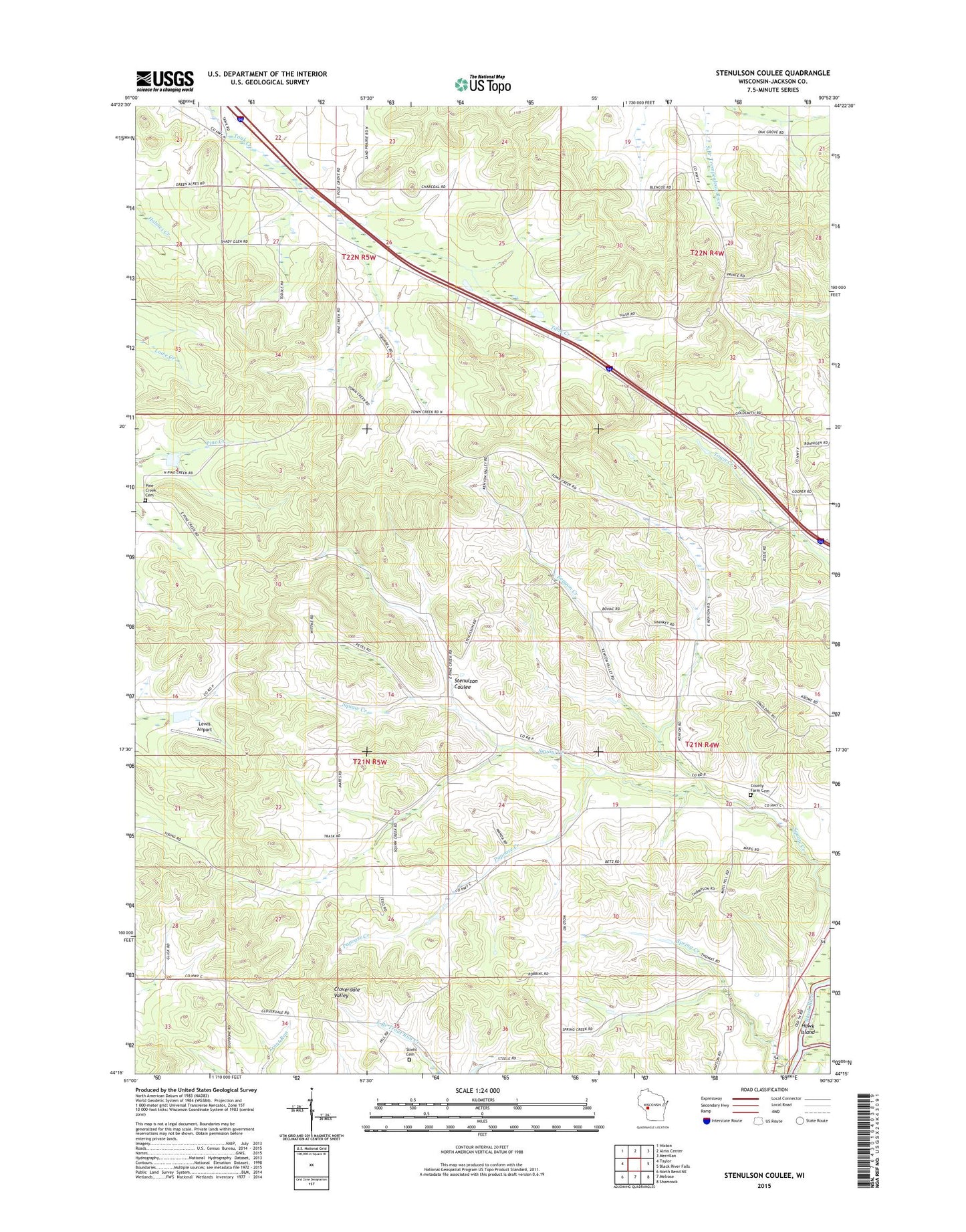
2023 topographic map quadrangle Stenulson Coulee in the state of Wisconsin. Scale: 1:24000. Based on the newly updated USGS 7.5' US Topo map series, this map is in the following counties: Jackson. The map contains contour data, water features, and other items you are used to seeing on USGS maps, but also has updated roads and other features. This is the next generation of topographic maps. Printed on high-quality waterproof paper with UV fade-resistant inks.
Quads adjacent to this one:
West: Taylor
Northwest: Hixton
North: Alma Center
Northeast: Merrillan
East: Black River Falls
Southeast: Shamrock
South: Melrose
Southwest: North Bend NE
This map covers the same area as the classic USGS quad with code o44090c8.
Contains the following named places: 0.94 Reservoir, 1.18 Reservoir, Cloverdale School, County Farm Cemetery, Hoffman Creek, Kenyon Creek, Kenyon School, Lewis Airport, Lewis E6092 Dam, Ludeman G924 Dam, Oak Grove School, Papoose Creek, Papoose Creek School, Pine Creek Cemetery, Shady Glen School, Spring Creek, Spring Creek School, Squaw Creek Church, Squaw Creek School, Stenulson Coulee, Stiehl Nortmann Cemetery, Town Creek School, Town of Albion, WWIS-FM (Black River Falls)