MyTopo
Hollandale Wisconsin US Topo Map
Couldn't load pickup availability
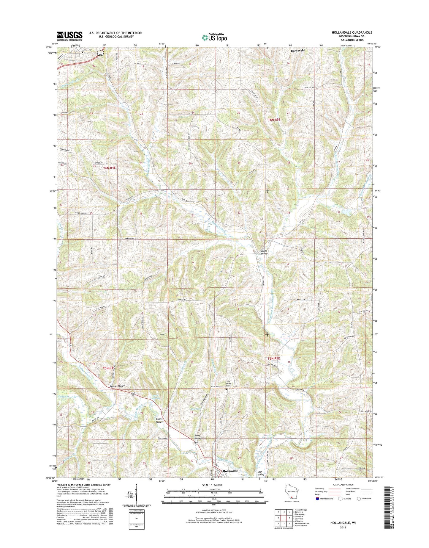
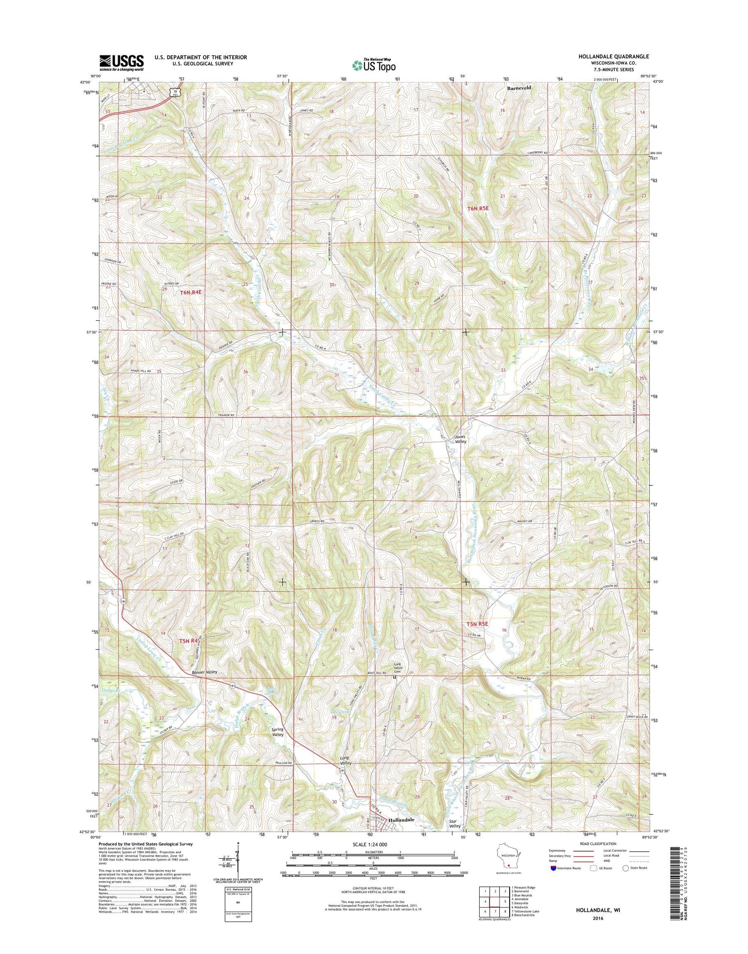
2018 topographic map quadrangle Hollandale in the state of Wisconsin. Scale: 1:24000. Based on the newly updated USGS 7.5' US Topo map series, this map is in the following counties: Iowa. The map contains contour data, water features, and other items you are used to seeing on USGS maps, but also has updated roads and other features. This is the next generation of topographic maps. Printed on high-quality waterproof paper with UV fade-resistant inks.
Quads adjacent to this one:
West: Jonesdale
Northwest: Pleasant Ridge
North: Barneveld
Northeast: Blue Mounds
East: Daleyville
Southeast: Blanchardville
South: Yellowstone Lake
Southwest: Waldwick
Contains the following named places: 0.5 Reservoir, 1 Reservoir, 53507, 53544, Adamsville, Banner Valley, Conley Lewis Creek, Desmet Airport, Hollandale, Hollandale Post Office, Jones Valley, Long Valley, Long Valley Cemetery, Long Valley Creek, Middlebury, Middlebury Church, Nelson G 7414 Dam, Ridgeway Elementary School, Ridgeway Marshal's Office, Ridgeway Post Office, Ryan Spring, Smith Conley Creek, Spring Valley, Star Valley, Town of Brigham, Town of Ridgeway, Urnus Creek, Village of Hollandale, Village of Ridgeway, Warzyn G-8862 Dam, Whitford Creek, Williams-Barneveld Creek