MyTopo
Yellowstone Lake Wisconsin US Topo Map
Couldn't load pickup availability
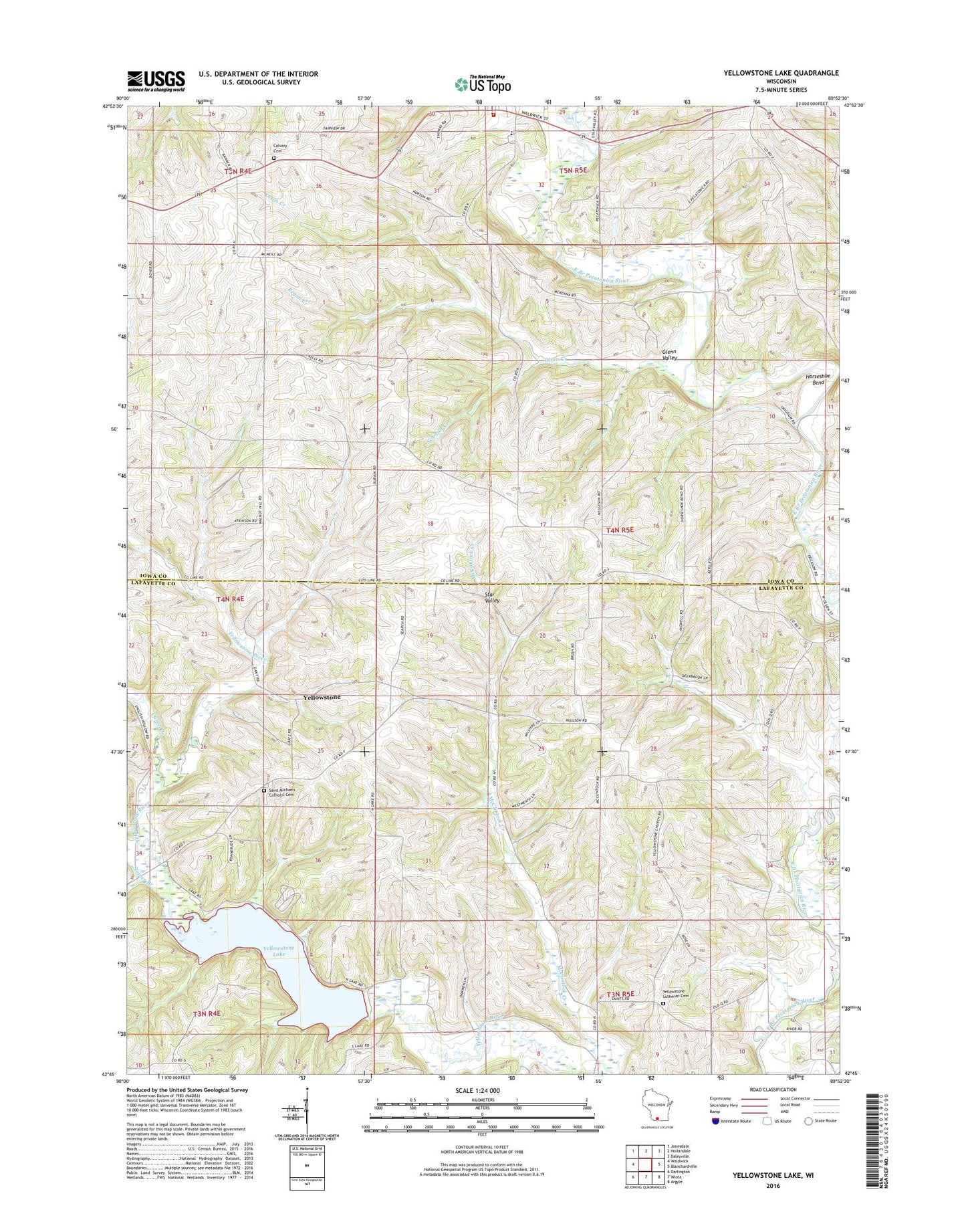
2022 topographic map quadrangle Yellowstone Lake in the state of Wisconsin. Scale: 1:24000. Based on the newly updated USGS 7.5' US Topo map series, this map is in the following counties: Iowa, Lafayette. The map contains contour data, water features, and other items you are used to seeing on USGS maps, but also has updated roads and other features. This is the next generation of topographic maps. Printed on high-quality waterproof paper with UV fade-resistant inks.
Quads adjacent to this one:
West: Waldwick
Northwest: Jonesdale
North: Hollandale
Northeast: Daleyville
East: Blanchardville
Southeast: Argyle
South: Wiota
Southwest: Darlington
This map covers the same area as the classic USGS quad with code o42089g8.
Contains the following named places: Canon Creek, Dodge Branch, Durkin School, Glenn Valley, Hidden Valley Lake 1, Hidden Valley Lake G6316 Dam, Hollandale Volunteer Fire Department, Hollandale Wastewater Treatment Facility, Horseshoe Bend, McClintock Creek, Moscow Center School, Olson Creek, Pecatonica Elementary School, Prairie School, Regan Creek, Saint Michaels Catholic Cemetery, Saint Michaels Church, Saint Patricks Calvary Cemetery, Schmidt Creek, Steiner Branch, Town of Blanchard, Town of Moscow, Woodlawn School, Yellowstone, Yellowstone 2WP88652 Dam, Yellowstone Church, Yellowstone Conservation Area, Yellowstone Lake, Yellowstone Lake 18, Yellowstone Lutheran Cemetery, Yellowstone Savanna State Natural Area