MyTopo
Jump River Wisconsin US Topo Map
Couldn't load pickup availability
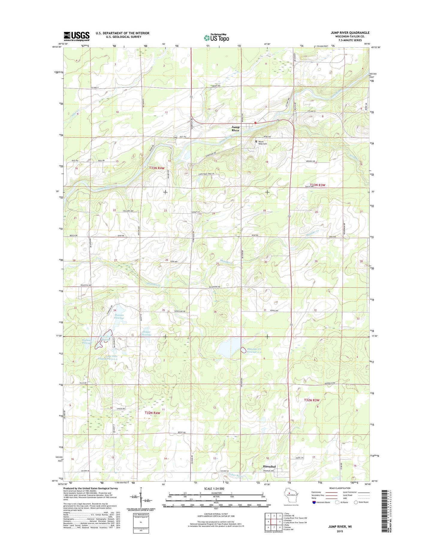
2022 topographic map quadrangle Jump River in the state of Wisconsin. Scale: 1:24000. Based on the newly updated USGS 7.5' US Topo map series, this map is in the following counties: Taylor. The map contains contour data, water features, and other items you are used to seeing on USGS maps, but also has updated roads and other features. This is the next generation of topographic maps. Printed on high-quality waterproof paper with UV fade-resistant inks.
Quads adjacent to this one:
West: Sheldon
Northwest: Tony
North: Sheldon NE
Northeast: Jump River Fire Tower NW
East: Jump River Fire Tower SW
Southeast: Lublin NW
South: Gilman
Southwest: Ruby
This map covers the same area as the classic USGS quad with code o45090c7.
Contains the following named places: Dorau Pond, Dorau Pond G12.575 Dam, Ellis Flowage G12.575 Dam, Gebhardt Reservoir Dam, Hannibal, Holzer Flowage, Holzer Flowage G12.575 Dam, Jump River, Jump River Census Designated Place, Jump River Volunteer Fire Department, Lake 31 6 15, Lake Ellis Flowage 3-3-0.3, Levitt Creek, Monson Flowage, Monson Flowage G12.575 Dam, Mount Nebo Cemetery, Pershing Wildlife Area 1 G12.575 Dam, Pioneer School, Quinn Flowage 1, Redman Flowage, Redman Flowage G12.575 Dam, Shoulder Creek Flowage 0.2, Shoulder Creek Flowage G12.575 Dam, Sunnyside School, Town of McKinley, Waterfowl Flowage, Wood Prairie School, ZIP Code: 54766