MyTopo
Ruby Wisconsin US Topo Map
Couldn't load pickup availability
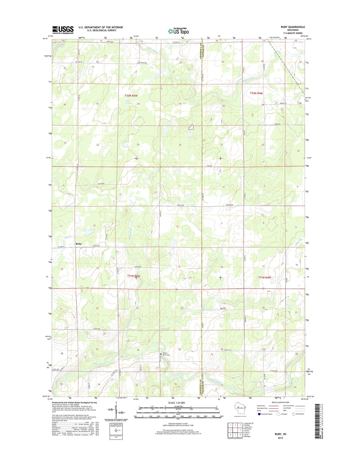
2022 topographic map quadrangle Ruby in the state of Wisconsin. Scale: 1:24000. Based on the newly updated USGS 7.5' US Topo map series, this map is in the following counties: Chippewa, Taylor. The map contains contour data, water features, and other items you are used to seeing on USGS maps, but also has updated roads and other features. This is the next generation of topographic maps. Printed on high-quality waterproof paper with UV fade-resistant inks.
Quads adjacent to this one:
West: Holcombe
Northwest: Ladysmith SE
North: Sheldon
Northeast: Jump River
East: Gilman
Southeast: Bellinger
South: Huron
Southwest: Colburn
This map covers the same area as the classic USGS quad with code o45090b8.
Contains the following named places: Christmas Creek, Elder Creek, Farm Service Agency Interest of Wisconsin, Mayflower School, Ruby, Ruby Swamps, Saint Johns Church, Sunnyview School, Town of Ruby, Yellow River Community Cemetery