MyTopo
Sheldon Wisconsin US Topo Map
Couldn't load pickup availability
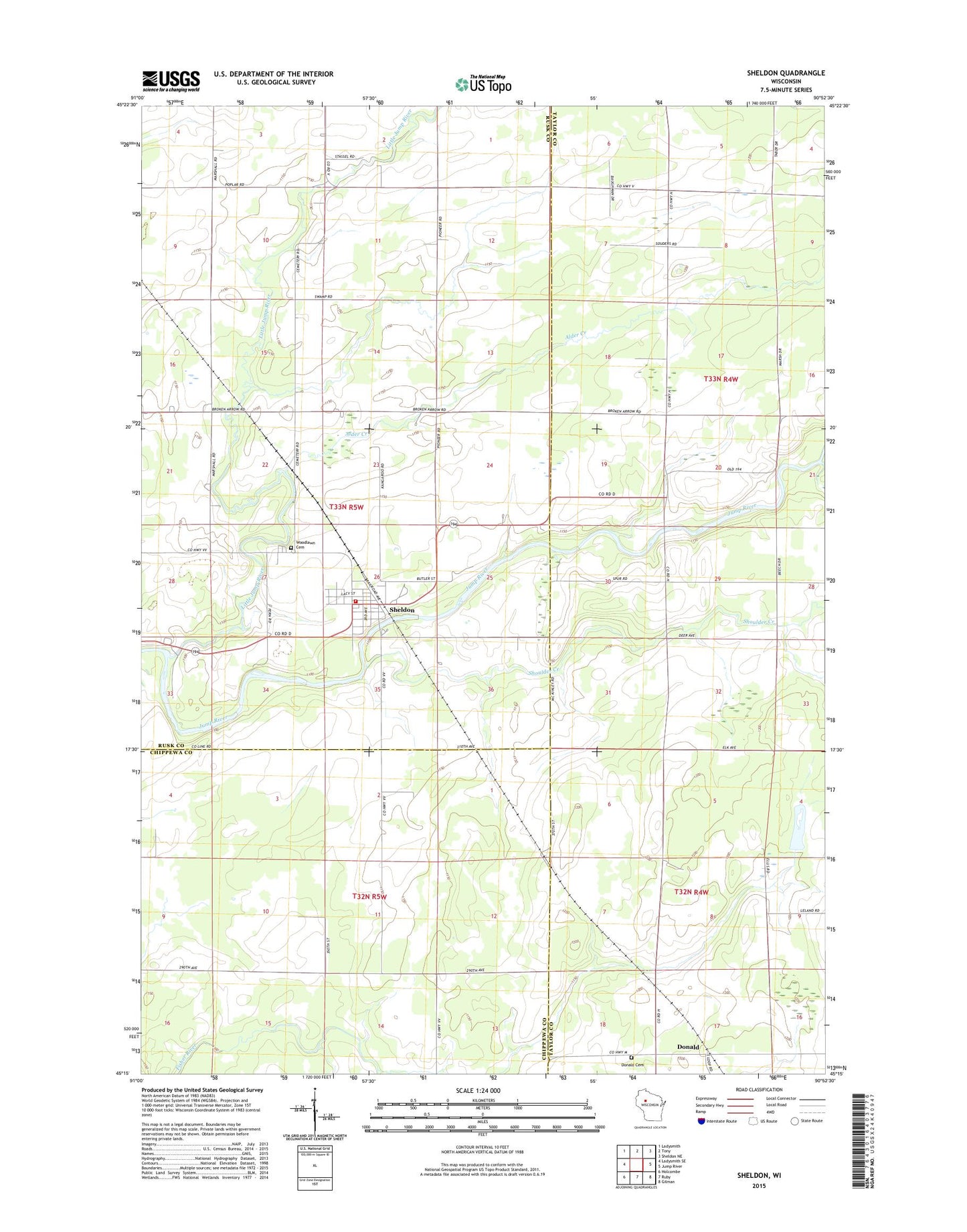
2022 topographic map quadrangle Sheldon in the state of Wisconsin. Scale: 1:24000. Based on the newly updated USGS 7.5' US Topo map series, this map is in the following counties: Taylor, Rusk, Chippewa. The map contains contour data, water features, and other items you are used to seeing on USGS maps, but also has updated roads and other features. This is the next generation of topographic maps. Printed on high-quality waterproof paper with UV fade-resistant inks.
Quads adjacent to this one:
West: Ladysmith SE
Northwest: Ladysmith
North: Tony
Northeast: Sheldon NE
East: Jump River
Southeast: Gilman
South: Ruby
Southwest: Holcombe
This map covers the same area as the classic USGS quad with code o45090c8.
Contains the following named places: Alder Creek, Baughman School, Donald, Donald Cemetery, Linden Christian School, Linden School, Little Jump River, Marshall Center School, Mennonite Church, Riverdale School, Sheldon, Sheldon Elementary School, Sheldon Estates, Sheldon Fire Protection District, Sheldon Post Office, Shoulder Creek, Town of Marshall, Village of Sheldon, Woodlawn Cemetery