MyTopo
Junction City Wisconsin US Topo Map
Couldn't load pickup availability
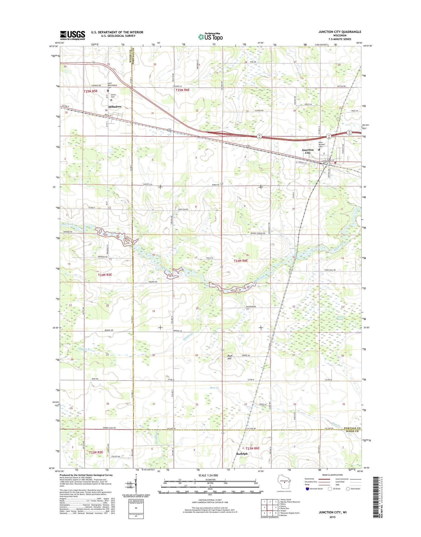
2018 topographic map quadrangle Junction City in the state of Wisconsin. Scale: 1:24000. Based on the newly updated USGS 7.5' US Topo map series, this map is in the following counties: Portage, Wood. The map contains contour data, water features, and other items you are used to seeing on USGS maps, but also has updated roads and other features. This is the next generation of topographic maps. Printed on high-quality waterproof paper with UV fade-resistant inks.
Quads adjacent to this one:
West: Sherry
Northwest: Honey Island
North: Big Eau Pleine Reservoir
Northeast: Dancy
East: Rocky Run
Southeast: Meehan
South: Wisconsin Rapids North
Southwest: Vesper
Contains the following named places: Fogarty Marsh, Hayden Creek, Junction City, Junction City Post Office, Junction City Wastewater Treatment Plant, Kennedy Elementary School, Lone Elm School, Lone Maple School, Mill Creek School, Milladore, Rock Hill, Rudolph Volunteer Fire Department Station 5, Saint Michael's Cemetery, Saint Wenceslaus Cemetery, Sunrise Valley School, Union Cemetery, Victory School, Village of Junction City, Village of Milladore, ZIP Code: 54443