MyTopo
Lena Wisconsin US Topo Map
Couldn't load pickup availability
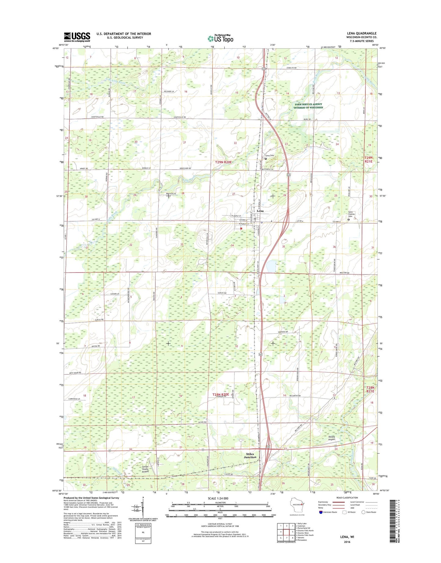
2022 topographic map quadrangle Lena in the state of Wisconsin. Scale: 1:24000. Based on the newly updated USGS 7.5' US Topo map series, this map is in the following counties: Oconto. The map contains contour data, water features, and other items you are used to seeing on USGS maps, but also has updated roads and other features. This is the next generation of topographic maps. Printed on high-quality waterproof paper with UV fade-resistant inks.
Quads adjacent to this one:
West: Oconto Falls North
Northwest: Kelly Lake
North: Coleman
Northeast: Porterfield SW
East: Oconto West
Southeast: Pensaukee
South: Abrams
Southwest: Oconto Falls South
This map covers the same area as the classic USGS quad with code o44088h1.
Contains the following named places: Birch Grove School, Busy School, Dolata Airport, Kelly Brook, Larson Studio Airport, Learn Charter School, Lena, Lena Cemetery, Lena Elementary School, Lena Middle - High School, Lena Middle School, Lena Police Department, Lena Post Office, Lena Volunteer Fire Department, Lena Wastewater Treatment Facility, Maranatha Seventh - Day Adventist Christian School, Matravers Landing Field, Meadow Brook School, North Branch Little River, Pershing School, Saint Charles Cemetery, Stiles Junction, Stiles Junction School, Sunshine School, Town of Lena, Town of Stiles, Village of Lena, ZIP Code: 54139