MyTopo
Kempster Wisconsin US Topo Map
Couldn't load pickup availability
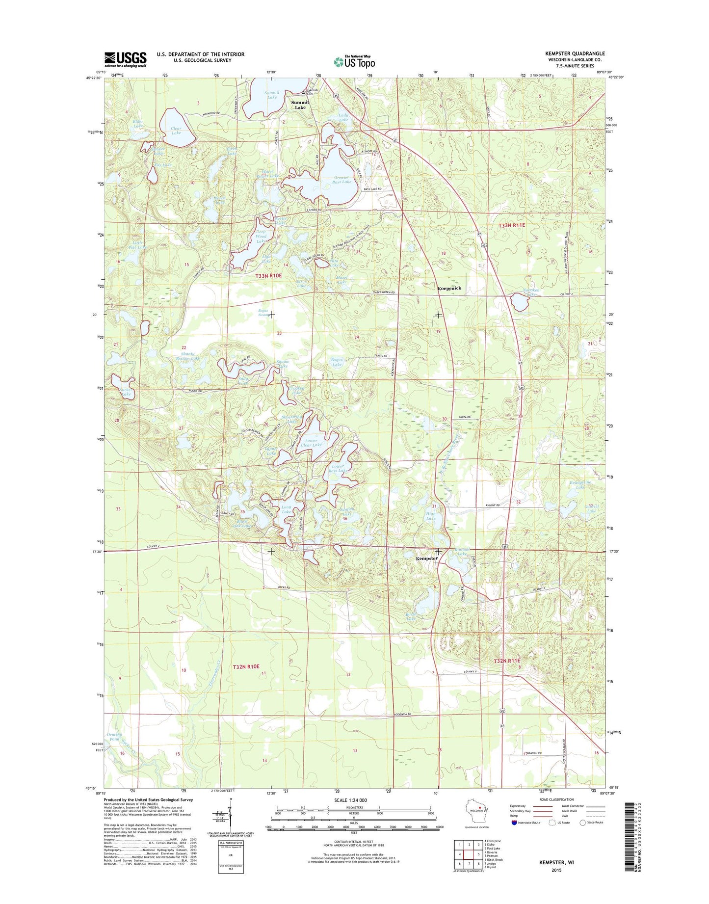
2018 topographic map quadrangle Kempster in the state of Wisconsin. Scale: 1:24000. Based on the newly updated USGS 7.5' US Topo map series, this map is in the following counties: Langlade. The map contains contour data, water features, and other items you are used to seeing on USGS maps, but also has updated roads and other features. This is the next generation of topographic maps. Printed on high-quality waterproof paper with UV fade-resistant inks.
Quads adjacent to this one:
West: Bavaria
Northwest: Enterprise
North: Elcho
Northeast: Post Lake
East: Pearson
Southeast: Bryant
South: Antigo
Southwest: Black Brook
Contains the following named places: Alga Lake, Alta Lake, Bass Lake Country Club, Beaver Lake, Birch Lake, Black Oak Lake, Bogus Lake, Bogus Swamp, Bogus Swamp State Natural Area, Borth Lake, Chub Lake, Clear Lake, Crooked Lake, Deep Wood Lake, Elder Lake, Evangeline Lake, Forest School, Fox Lake, Gabriel Lake, Greater Bass Lake, Hazel Lake, High Lake, Indian Lake, Kempster, Kettle Lake, Kimball Lake, Koepenick, Lady Lake, Lakeside Cemetery, Little Chicago School, Little Pike Lake, Long Lake, Lower Bass Lake, Lower Clear Lake, McDonald Lake, Noboken Lake, Ormsby Dam, Perch Lake, Shanty Bottom Lake, Shoestring Lake, Snag Lake, Squaw Lake, Sucker Lake, Summit Lake, Sunfish Lake, Susan Lake, Town of Upham, Typner Lake, Water Power Lake, WRLO-FM (Antigo), ZIP Code: 54424