MyTopo
Post Lake Wisconsin US Topo Map
Couldn't load pickup availability
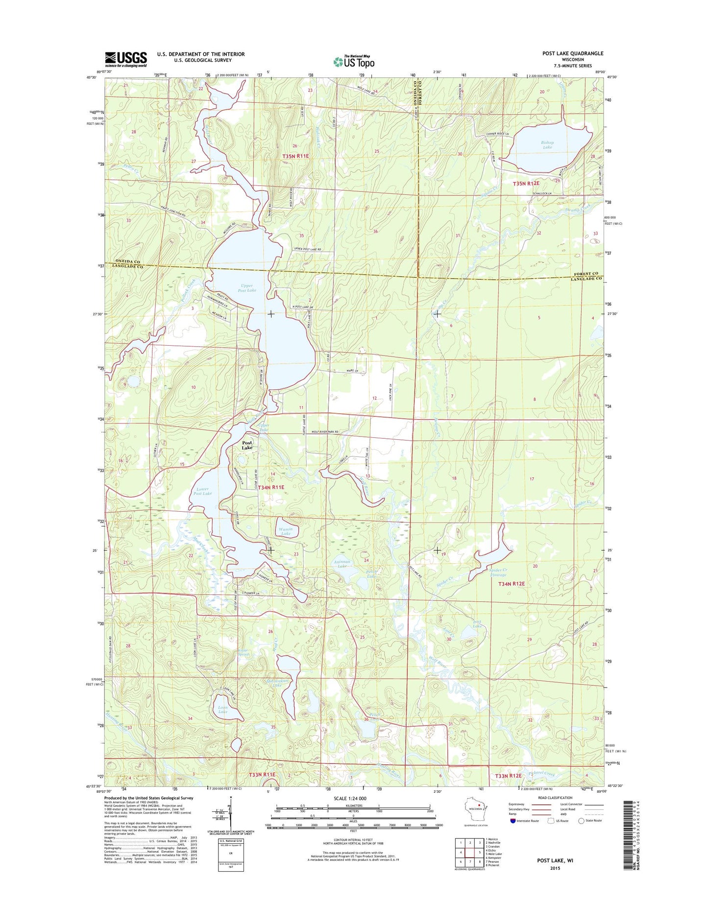
2023 topographic map quadrangle Post Lake in the state of Wisconsin. Scale: 1:24000. Based on the newly updated USGS 7.5' US Topo map series, this map is in the following counties: Langlade, Oneida, Forest. The map contains contour data, water features, and other items you are used to seeing on USGS maps, but also has updated roads and other features. This is the next generation of topographic maps. Printed on high-quality waterproof paper with UV fade-resistant inks.
Quads adjacent to this one:
West: Elcho
Northwest: Monico
North: Nashville
Northeast: Crandon
East: Mole Lake
Southeast: Pickerel
South: Pearson
Southwest: Kempster
This map covers the same area as the classic USGS quad with code o45089d1.
Contains the following named places: Aninnan Lake, Bishop Lake, Knoke Spring, Logan Creek, Loon Lake, Lost Creek, Lost Lake, Lower Post Lake, Marigold Lake, Miniwakan Lake, Mud Creek, Pedro Creek, Perch Lake, Pickerel Creek, Pollock Creek, Post Lake, Post Lake Census Designated Place, Spider Creek, Spider Creek 2WP1403 Dam, Spider Creek Flowage, Squaw Creek, Swamp Creek, Upper Lake, Upper Post Lake, Upper Post Lake 1866C352 Dam, Walczak Creek, Wamin Lake, ZIP Code: 54462