
MyTopo
Ladysmith SE Wisconsin US Topo Map
Couldn't load pickup availability
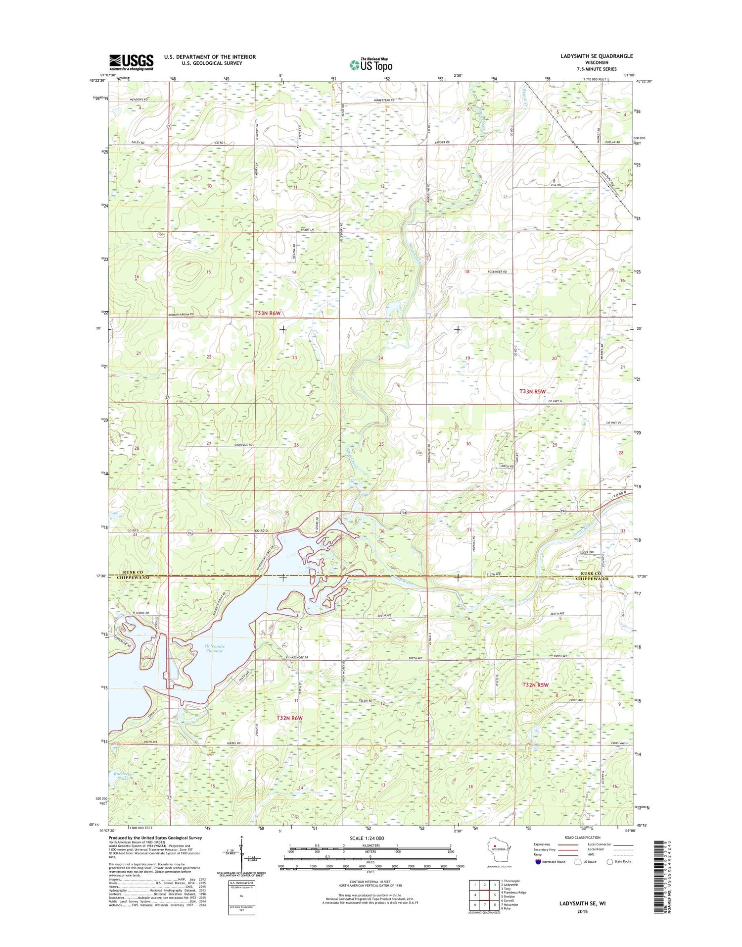
2018 topographic map quadrangle Ladysmith SE in the state of Wisconsin. Scale: 1:24000. Based on the newly updated USGS 7.5' US Topo map series, this map is in the following counties: Rusk, Chippewa. The map contains contour data, water features, and other items you are used to seeing on USGS maps, but also has updated roads and other features. This is the next generation of topographic maps. Printed on high-quality waterproof paper with UV fade-resistant inks.
Quads adjacent to this one:
West: Flambeau Ridge
Northwest: Thornapple
North: Ladysmith
Northeast: Tony
East: Sheldon
Southeast: Ruby
South: Holcombe
Southwest: Cornell
Contains the following named places: Main Creek, Maple Grove School, Oak View School, Riverside School, Roedecker Lake, Roy School, Shiloh Christian School, Skunk Creek, Town of Willard, Wayside Mission, Willard School, Willard Townhall, Wilson School, ZIP Codes: 54731, 54745


