MyTopo
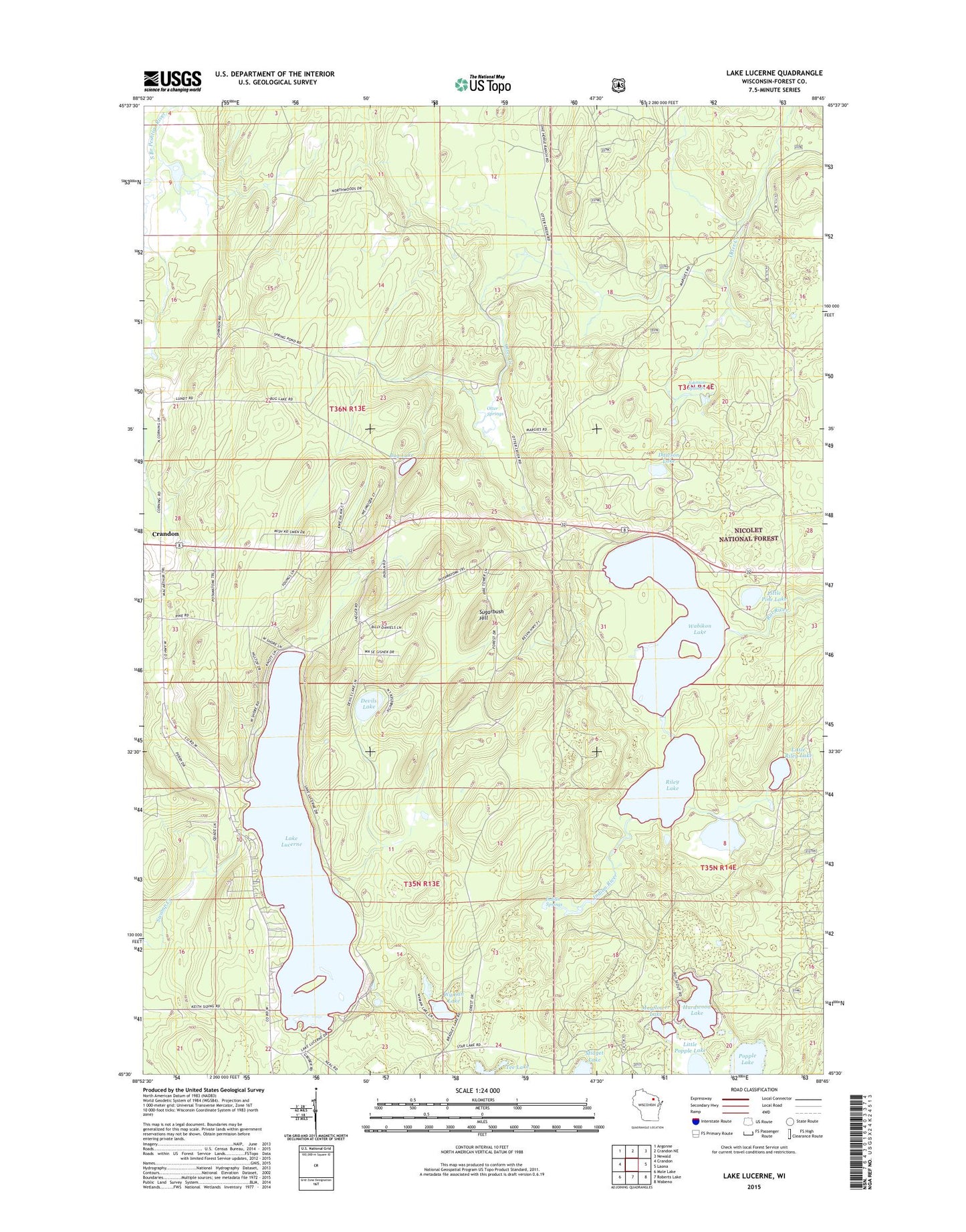
Lake Lucerne Wisconsin US Topo Map
Couldn't load pickup availability
Also explore the Lake Lucerne Forest Service Topo of this same quad for updated USFS data
2022 topographic map quadrangle Lake Lucerne in the state of Wisconsin. Scale: 1:24000. Based on the newly updated USGS 7.5' US Topo map series, this map is in the following counties: Forest. The map contains contour data, water features, and other items you are used to seeing on USGS maps, but also has updated roads and other features. This is the next generation of topographic maps. Printed on high-quality waterproof paper with UV fade-resistant inks.
Quads adjacent to this one:
West: Crandon
Northwest: Argonne
North: Crandon NE
Northeast: Newald
East: Laona
Southeast: Wabeno
South: Roberts Lake
Southwest: Mole Lake
This map covers the same area as the classic USGS quad with code o45088e7.
Contains the following named places: Bug Lake, Dawson Lake, Devils Lake, Forest County Potawatomi Community, Hardwood Lake, Indian River, Indian Springs, Johnson Springs, Kokoma School, Lake Lucerne, Lily Pad Lake, Little Pine Lake, Little Popple Lake, Little Riley Lake, Mayflower Lake, Midget Lake, Otter Springs, Popple Lake, Rat Lake Permanent Lookout Station, Riley Lake, Sugarbush Hill, Tee Lake, Town of Lincoln, Wabikon Lake, Wyman Lake